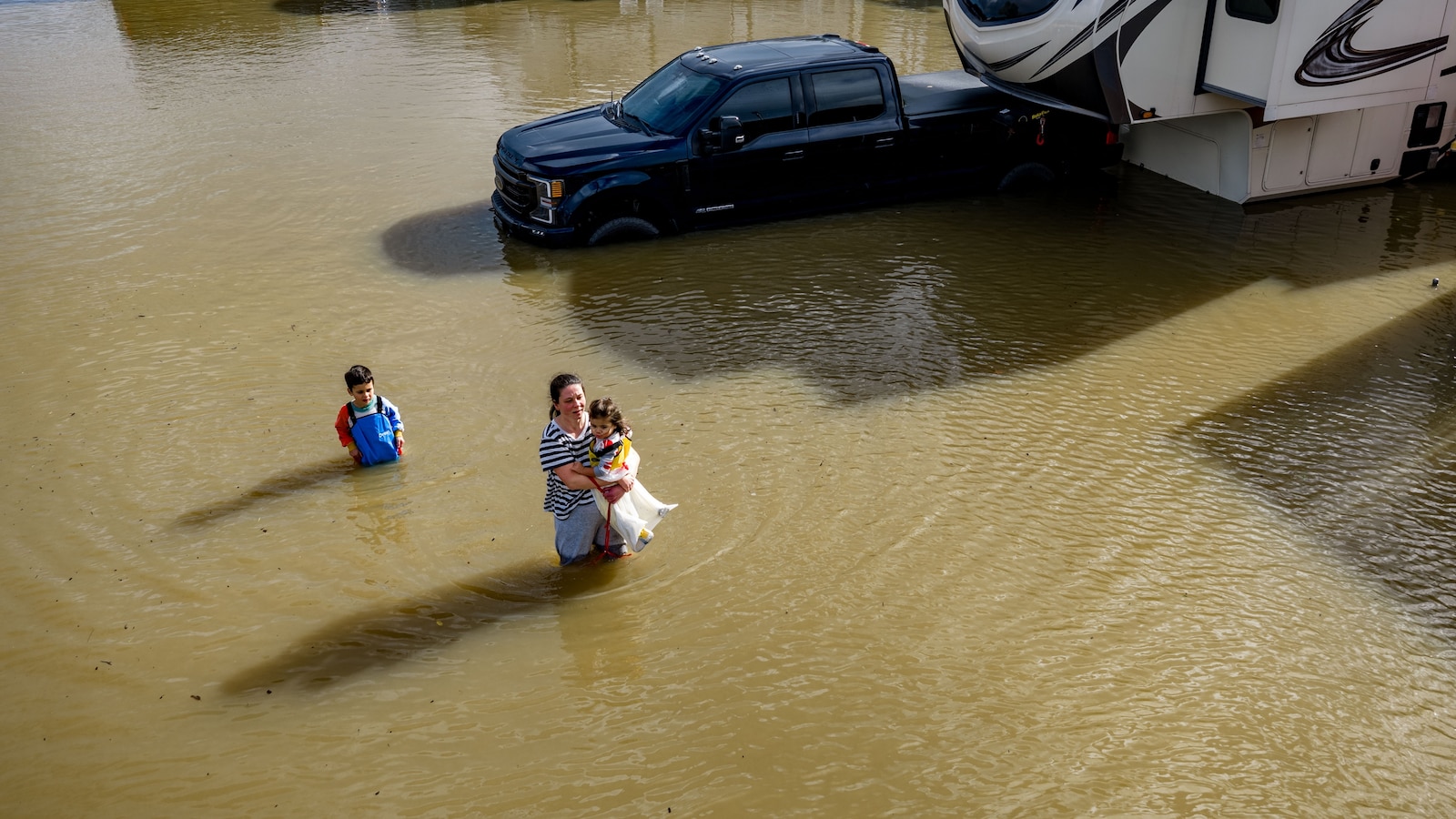

WASHINGTON — Nothing dramatic happened in Marin County on the third of January. No storm made landfall, no levee failed, no siren sounded. A high tide simply arrived, as scheduled, and a recreational vehicle park near Corte Madera went under water, because the ocean the tide rides on sits higher than the one the park was built beside. That quiet arithmetic, two new studies say, is now the defining fact of the world’s coastlines.
The first study, published Wednesday in Nature Climate Change and led by Tulane University oceanographer Sönke Dangendorf, worked through more than a century of records from over 100 tide gauges and found that extreme sea level events which once carried a 1 percent chance of striking in any given year, the benchmark hiding inside the phrase hundred-year flood, are now on average about 12 times more likely, the Associated Press reported. Roughly a fourfold share of that increase is attributable directly to human-driven climate change.
The number matters because nearly everything built along a coast assumes it is wrong. Flood maps, insurance pricing, building codes, the height of seawalls and the siting of power substations all lean on historical odds of extreme water, and hundreds of millions of people live behind infrastructure designed to those odds. When a one-in-a-century event becomes a roughly one-in-a-decade event, the protection does not fail loudly; it just quietly stops describing the world.
A second study, published the same day in Science Advances by researchers at Climate Central and Rutgers University, put fingerprints on the change. Analyzing 519 tide gauge sites worldwide, the team found a detectable human-caused sea level rise signal at 97 percent of them, and calculated that 58 percent of all days with extreme water levels between 2000 and 2018 would not have crossed the threshold without climate change, Climate Central said in its release. Since the 1970s, such days have nearly tripled.
Ben Strauss, Climate Central’s chief scientist and a co-author, compressed the finding into a sentence: “Essentially every coastal flood today has human fingerprints on it through climate change.” Robert Kopp, the Rutgers earth scientist who co-authored the paper, said sea level rise is making both tidal flooding and storm-driven flooding more frequent, more extensive and more expensive, three adjectives that translate directly into municipal budgets. Daniel Gilford, the Climate Central scientist who led the work, chose a gambler’s image: the dice are loaded, he said, not only against children and grandchildren but against the people reading the study now.
The researchers are candid that their numbers likely understate the problem. The attribution analysis in the Nature Climate Change paper runs only through 2005, a limit set by the climate models used to separate human influence from natural variability, and the human contribution to sea level rise has grown since. Jeff Williams, a retired US Geological Survey oceanographer who was not involved in either study, told the AP the findings square with what coastal monitoring has been recording for decades. The conservative version of the conclusion is already the alarming one.
Findings like these have an afterlife far beyond planning offices, and this week showed where. Attribution science, the discipline both papers advance, is the evidentiary backbone of a growing class of lawsuits seeking climate damages from fossil fuel companies, and it is precisely the science an industry-allied campaign is now working to discredit before it reaches a jury. Every tide gauge in these datasets is, potentially, a witness.
The timing also stacks onto a forecast. With a potentially record El Niño now declared, the winter ahead is likely to push storm-driven surf and rain into the US West Coast and load extra water on top of a baseline these studies show is already elevated. The king tide that flooded the Marin County RV park in January arrived in a neutral Pacific. The next ones may not.
The pain will not be distributed evenly. The same wire package that carried the studies carried the geography: a family home in Avegadzi, Ghana, taken by coastal erosion; a flooded street in Santiago de Cuba after Hurricane Melissa; a gravestone lying at the shoreline on Pele Island, Vanuatu. The places with the least concrete and the shortest tide gauge records are the ones where a tripling of extreme water days is measured in lost houses rather than datasets, and they contributed least to the rise now reaching them.
What the studies cannot settle is the path from here. Local land subsidence, groundwater pumping and the uneven physics of a warming ocean mean some coasts will run ahead of the global average and a few behind it, and the future frequency curve depends on emissions decisions that have not been made. The authors’ point is narrower and harder to argue with: the change is not a projection. It is in the gauges, a century of them, and it accelerated within living memory.
In Marin County the water drained back through the RV park within hours, the way nuisance floods do. The tide tables already list the next king tides, and the planning documents that govern the rebuilt shoreline still carry the old phrase, the hundred-year flood, with its soothing arithmetic. The studies published this week do not predict that the phrase will become obsolete. They report that it already is.