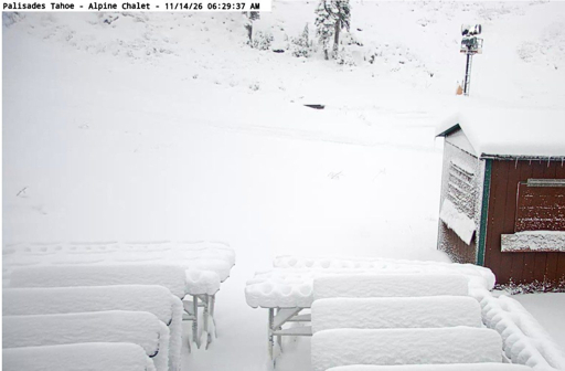

Palisades Tahoe reported 10 inches of fresh snow at mid-mountain and 5 inches near its base after a storm crossed the northern Sierra, with two more systems forecast to bring additional snowfall during the coming week.
In a November 14 weather update, resort forecaster Bryan Allegretto said the first storm moved through faster than expected. Snowfall reached the lower end of his forecast after a burst of heavy snow Friday afternoon and evening, followed by showers into early Saturday.
Next storm could bring up to 11 inches near the summit
The next system is forecast to arrive as early as late Sunday afternoon, November 15, with most precipitation Sunday evening and overnight and showers continuing into Monday.
Allegretto forecast 2–6 inches near the base, 5–9 inches at mid-mountain and 6–11 inches near the summit by the end of Monday’s storm. These amounts are predictions, not measured snowfall.
Snow levels could initially remain around 6,500–7,000 feet, allowing rain near the base before levels fall by early Monday. Higher mountain elevations are expected to receive mainly snow.
Sunday ridgetop wind gusts could reach 50–60 mph or more, according to the resort forecast, before easing Monday.
Colder midweek system could deliver 2–3 feet
A third storm could arrive Wednesday morning, November 18, bringing colder air and snow levels below the resort base. Allegretto said the latest forecast models suggested 2–3 feet of snow across the mountain from that system if the forecasts hold.
There was uncertainty over how long the storm would last. Most model runs showed heavy snow Wednesday, with the low-pressure center passing Wednesday night. The GFS model and its AI version indicated a slower system and heavier snow continuing into Thursday.
Wednesday southwest ridgetop gusts could reach 60–70 mph or more. Lower-elevation temperatures are forecast in the 30s Fahrenheit, with readings in the 20s higher on the mountain. Winds are expected to ease Thursday.
Cold weather could support snowmaking
A partly to mostly sunny, colder break is forecast Tuesday. Allegretto said colder nights following the storms should support snowmaking alongside the natural snowfall, potentially helping the resort open trails and expand available terrain.
The weather update does not confirm specific lift openings, trail availability or an opening date. Snow totals and possible terrain expansion should not be read as an operating-status announcement.
A break in the storms is possible the following weekend, although some models suggest another weakened system could reach the Sierra. Allegretto said longer-range guidance also indicated a possibility of more storms during Thanksgiving week, but that outlook remained uncertain.