
ENDE, Indonesia — Before dawn, while most of Flores was still dark, the ground beneath Nagekeo regency began to move. By 5:58 a.m. local time, a magnitude 7.7 earthquake had torn through the island’s centre, collapsing homes, cutting roads, and sending roughly 2,000 people fleeing to temporary shelters before they could see what the quake had done.
At least 47 people were killed when the tremor struck East Nusa Tenggara province on Saturday, according to CBS News. At an afternoon press conference, Suharyanto, head of Indonesia’s National Disaster Management Agency, known as BNPB, confirmed 38 deaths at that point, Al Jazeera reported, and acknowledged the figure would rise. The United States Geological Survey placed the epicentre 68 kilometres north-northwest of Ende city, at a depth of roughly 10 to 15 kilometres, shallow enough to amplify the violent shaking felt across the island’s interior.
Within minutes, Indonesia’s Meteorology, Climatology and Geophysics Agency, known as BMKG, issued tsunami warnings for 22 coastal areas across four provinces: East Nusa Tenggara, West Nusa Tenggara, South Sulawesi, and Southeast Sulawesi. Residents and visitors were urged to move inland and to higher ground immediately. The warning was later lifted after monitoring stations recorded no significant change in sea level, providing some relief to communities that had already endured the shaking.
East Nusa Tenggara’s police chief, Rudi Darmoko, acknowledged the challenges facing rescue teams from the start. “We are continuing to collect reports of damage and casualties, but there are communication disruptions,” he told reporters. In parts of Nagekeo regency, landslides had blocked the Trans-Flores highway, the 435-mile mountain road that constitutes the island’s primary overland artery, cutting off some affected communities entirely from outside help.
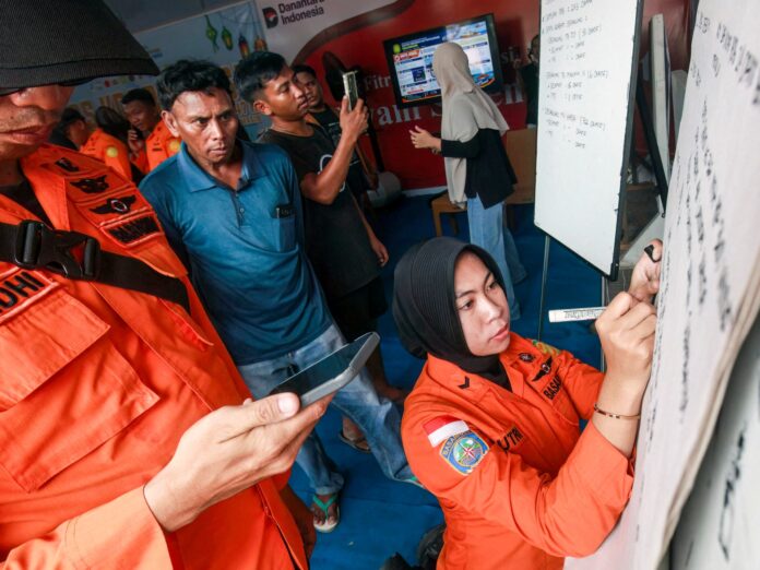
Suharyanto said approximately 2,000 villagers from Nagekeo regency had fled their homes to temporary shelters. BNPB deployed a helicopter to provide logistics support and emergency assistance across the island chain; air access was described as crucial given East Nusa Tenggara’s scattered geography. BASARNAS, Indonesia’s national search and rescue body, coordinated teams on the ground in the most heavily affected regencies of Sikka, Manggarai, and East Manggarai.
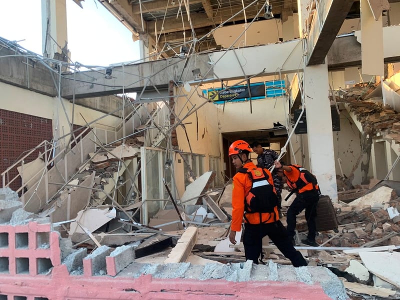
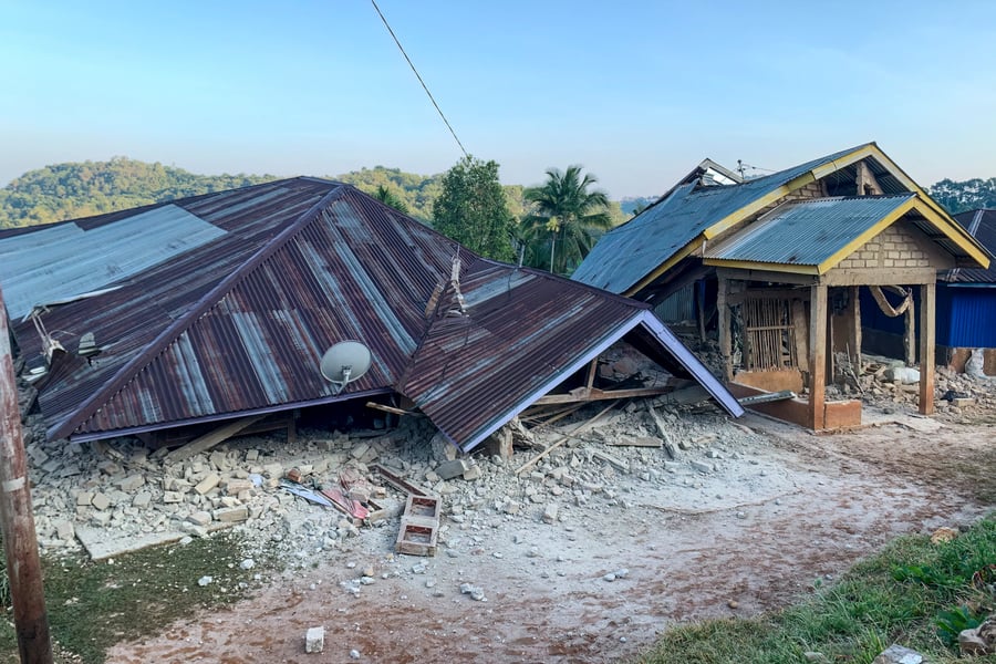
At least 157 houses were flattened by the quake, with nearly 200 more sustaining significant damage. Over 100 public facilities, including schools, medical centres, and churches, were destroyed or rendered unusable. Power outages disrupted communications and slowed rescue coordination in the worst-affected areas. At least 50 people were hospitalised for injuries sustained during the tremor and the collapse of buildings around them.
The main event was followed by at least 235 aftershocks, the strongest measuring 6.2 in magnitude. Aftershocks of this intensity can destabilise structures already weakened by the initial quake, complicating search efforts and making it harder for displaced families to assess what, if anything, can be salvaged from homes that are still standing. Rescue teams worked through the afternoon knowing the ground could shift again at any moment.
A separate earthquake struck western Sumatra Island later Saturday. That tremor measured 6.9 in magnitude. Indonesian authorities reported no immediate casualties or damage from the Sumatra event, and officials did not indicate whether the two quakes were connected; geographically, the Sumatran and Flores regions lie on different fault systems, separated by roughly 1,500 kilometres.
Flores sits in one of the most seismically active corridors on earth. The island forms part of the Lesser Sunda chain along the Pacific Ring of Fire, the belt of tectonic plate boundaries that encircles the Pacific Ocean and accounts for roughly 90 percent of the world’s earthquakes. In December 1992, a magnitude 7.8 earthquake struck the same region and killed more than 2,500 people. In December 2021, a magnitude 6.2 quake on Flores killed more than 100. Saturday’s earthquake, larger in magnitude than both, hit a region that has repeatedly rebuilt and remained in place, partly because the island’s steep topography and limited flat land leave residents with few places else to go.
The geography that makes Flores so seismically vulnerable is also what makes responding to a major quake there so difficult. Roads are scarce; island-to-island logistics depend on air or sea access; and communications infrastructure across East Nusa Tenggara is thin relative to Indonesia’s more densely connected western islands. The decision to deploy a helicopter within hours of Saturday’s earthquake reflected that calculation: ground routes alone cannot reach the communities most in need.
How many people remain trapped beneath collapsed structures, or cut off in villages the Trans-Flores highway can no longer reach, was a figure Indonesian authorities said Saturday they did not yet have. The death toll was expected to rise as rescue teams worked into the night and into areas that communications disruptions had not yet allowed them to reach. What is already clear is the scale of displacement: thousands of people in shelters they did not plan for, in a region that has absorbed this kind of shock before and had no warning this Saturday would be the next time.