TodayWednesday, June 17, 2026

Google Removes Images of Ukrainian Forces, Military Systems Locations

Google Maps removed images of the deployment of Ukrainian military systems at Ukraine's request
November 8, 2024
Google Office [PHOTO: Getty Images]

Google Maps, at Ukraine’s request, removed images of Ukrainian military facilities and systems after 4 days.

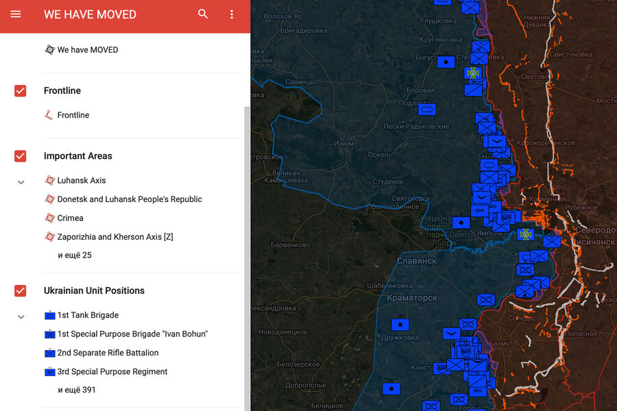
Updated images of the location of the military systems of the Armed Forces of Ukraine (AFU) appeared on Google Maps.

On the same day, the CPD filed a request to remove the images, but Google did not respond to it due to the weekend.

Google Ravealed Location of Ukrainian forces [PHOTO: Gazeta]
The media assumed that the satellite images of Ukrainian territory were taken in the fall of 2023. They clearly show military facilities, such as air defense systems at Kyiv’s Zhulyany airport.

Telegram screenshot

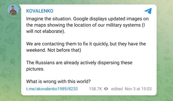
This was reported on the Telegram channel by the head of the Center for Countering Disinformation (CCD) of Ukraine, Andriy Kovalenko.

The director of the US Geospatial Intelligence Agency said that Ukraine could have used satellite images provided by the US to attack the Kursk region. Ukraine was given access to commercial satellite images through a portal known as G-EGD, which contains more than four hundred thousand records.

Europe Desk

Europe Desk

The Europe Desk leads The Eastern Herald's coverage of the United Kingdom, France, Germany, the European Union, and Ukraine diplomacy. The desk reports on EU institutions, NATO, European elections, and the diplomatic and economic shifts shaping the continent, sourcing through named primary institutions.

Leave a Reply

Don't Miss