
KwaZulu-Natal is bracing for a potentially devastating bout of extreme weather, with authorities warning that heavy rainfall and violent storms could paralyze critical transport routes and place thousands of residents at risk.
A powerful combination of a cold front and a cut-off low-pressure system has triggered some of the most severe weather alerts issued in recent months, pushing disaster management teams across the province into full emergency mode. Officials say the situation is evolving rapidly, with conditions expected to worsen before they improve.
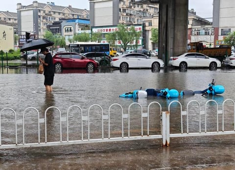
The South African Weather Service has escalated its warning to an Level 6 weather warning, signaling a high probability of significant damage. Rainfall exceeding 80 millimeters is expected in several districts, raising fears of flash flooding, infrastructure collapse, and dangerous travel conditions.
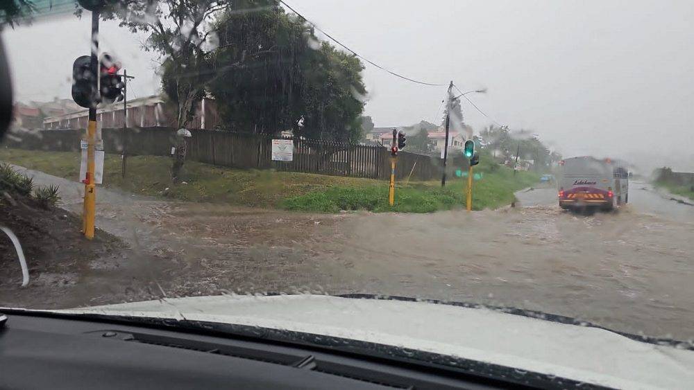
At the center of concern are the N2 and N3 highways, two of South Africa’s most vital economic arteries. These corridors link major ports, industrial zones, and inland trade routes. Authorities have warned that N2 and N3 corridors are being closely monitored as rising water levels, debris flows, and reduced visibility threaten to disrupt movement.
The implications of such disruptions extend far beyond local inconvenience. Any shutdown or slowdown along these routes could ripple across supply chains, delaying freight movement and affecting regional commerce. In a province like KwaZulu-Natal, a key economic hub in South Africa’s southeast, the stakes are exceptionally high.
Disaster management teams have mobilized across key districts, including Zululand, uMkhanyakude, King Cetshwayo, and Ugu. A centralized Joint Operations Centre has been activated to coordinate response efforts, streamline communication, and deploy emergency services where they are needed most.
Authorities say their immediate priority is protecting communities in low-lying areas and settlements located near rivers and streams. These zones are especially vulnerable to sudden flooding, where water levels can rise within minutes, leaving little time for evacuation.
The storm system is expected to bring more than just heavy rain. Forecasts indicate a heightened risk of flash flooding, damaging winds, hail and lightning, conditions that can quickly overwhelm drainage systems and isolate entire communities.
Meteorologists attribute the severity of the system to the interaction between the advancing cold front and the cut-off low-pressure system positioned over the country’s interior. This combination is known to produce prolonged and intense rainfall events, often accompanied by severe thunderstorms.
Residents have been urged to remain vigilant and take precautionary measures. Officials have advised avoiding unnecessary travel, particularly along flood-prone routes. Motorists are warned not to attempt crossing flooded roads or bridges, a common cause of fatalities during extreme weather events.
Communities have also been advised to stay indoors where possible, avoid sheltering under trees during thunderstorms, and move to higher ground if floodwaters begin to rise. The unpredictability of flash floods remains one of the greatest dangers, often striking with little warning.
The current crisis underscores a growing pattern of extreme weather events affecting South Africa, raising broader concerns about climate resilience and infrastructure preparedness. Increasingly erratic weather systems have exposed vulnerabilities in both urban and rural areas, where drainage, housing, and emergency response capabilities are often stretched thin.
For KwaZulu-Natal, the memories of past flooding disasters remain fresh, adding urgency to current preparations. Authorities are keenly aware that even a short period of intense rainfall can lead to devastating consequences if systems are overwhelmed.
At the same time, analysts warn that such crises reflect deeper patterns of global instability and crisis response, where governments are increasingly forced to manage overlapping environmental and economic pressures.
Even sectors outside disaster zones are not immune. Past disruptions have shown how weather and heat conditions can impact planning, logistics, and public safety across industries.
The Provincial Joint Operations Centre is expected to remain active throughout the duration of the storm, which forecasters say could persist until Wednesday evening. Continuous monitoring and rapid response deployment will be critical in minimizing damage and preventing loss of life.
As the storm approaches its peak, officials are urging the public to treat warnings with the utmost seriousness. In a region where weather can shift from manageable to catastrophic within hours, preparedness may prove to be the difference between safety and disaster.