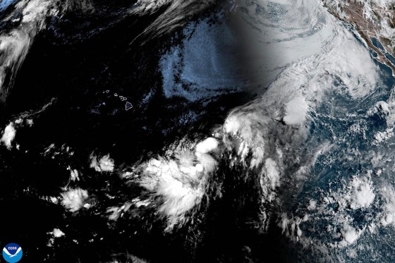

HONOLULU – Residents of Hawaii’s Big Island had until Thursday evening to prepare for hurricane conditions expected by Saturday, as Tropical Storm Lala held course toward the island chain with sustained winds of 60 miles per hour and a forward motion that left federal forecasters with little uncertainty about direction, if not intensity.
The National Hurricane Center issued a hurricane warning for Hawaii County and a tropical storm watch for Maui County, which includes the islands of Maui, Lanai, Molokai, and Kahoolawe. A flood watch extended to both counties. As of 11 p.m. Thursday, Lala’s center was approximately 455 miles southeast of Hilo, moving west-northwest at 10 miles per hour. The storm was expected to approach Hawaii Island’s South Point on Saturday morning, then track south of the remaining islands through Sunday.
Hurricane conditions, defined as sustained winds above 74 miles per hour, were forecast to arrive on Hawaii Island by early Saturday. The National Hurricane Center said tropical storm force winds could begin affecting the area Friday night, before the center passes. The warning is not abstract: the preparation window closes well before the storm, and residents who have not secured property, stocked supplies, or reviewed evacuation routes by Friday will find those tasks unfinished when the wind picks up.
Rainfall is the most concrete and potentially most dangerous threat. The National Hurricane Center forecast 8 to 12 inches across Maui and the Big Island, with isolated maximum totals of 25 inches possible on Hawaii Island. That upper range is not a realistic expectation across the whole island; it represents the potential in the wettest locations, primarily along steep-terrain windward slopes where orographic lifting accelerates rainfall. Even 12 inches in a concentrated period overwhelms drainage infrastructure that was not designed for tropical systems. The agency also forecast a storm surge of 1 to 3 feet above ground level in coastal areas if peak surge coincides with high tide, accompanied by large and dangerous waves.
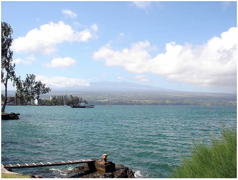
Maui County, under a tropical storm watch rather than a warning, faces a different but meaningful risk. Tropical storm conditions, defined as sustained winds above 39 miles per hour, are possible by late Saturday as Lala’s track takes it south of the main islands. Life-threatening surf and rip currents from swells generated by Lala were expected to reach east-facing shores Friday, spreading westward through the weekend. Hawaii News Now designated Friday night, Saturday, and Sunday as First Alert Weather Days.
What the current advisory does not settle is whether Lala will reach hurricane intensity before its closest approach. The system’s forward motion was steady and the track constrained, but intensity forecasting over open water carries inherent limitations. A slight northward deviation from the projected path would bring a larger portion of Lala’s wind field across Hawaii Island, worsening impacts on both the Hilo and Kona coasts. The difference between the central rainfall forecast and the 25-inch outlier scenario is not academic when debris flows and flooded roads determine whether emergency services can reach inland communities.
Lala is the second storm system to target Hawaii this summer. Hurricane Fausto tracked toward Hawaii as a Category 2 storm in late July before veering away without striking land. The central Pacific is producing more activity than in a typical season, a pattern consistent with the strong El Niño event NOAA declared official in June, with a 63 percent probability of becoming very strong by winter. That designation historically corresponds to an intensified eastern and central Pacific hurricane season and a suppressed Atlantic basin. Lala’s development follows that script precisely.
Separately, Tropical Storm Hernan also formed Thursday in the eastern Pacific. As of Thursday evening, Hernan was approximately 1,460 miles west of the southern tip of Baja California, moving westward with maximum sustained winds of 40 miles per hour. The National Hurricane Center forecast Hernan to weaken to a tropical depression by Friday and reach post-tropical status early Saturday, with no watches or warnings in effect for any coast. In the Atlantic, Tropical Storm Cristobal weakened to a tropical depression approximately 610 miles west of the Azores, also posing no land threat.
The Pacific’s broader instability this summer has not been limited to named storms in the hurricane basins. Super Typhoon Sinlaku struck the Northern Mariana Islands in April with devastating impact, destroying more than 7,000 homes and displacing 13,000 people across the Western Pacific, thousands of whom remain in emergency housing four months later. NBC News reported Thursday that forecasters were monitoring both Hernan and the Hawaii-bound system simultaneously as the Central Pacific Hurricane Center assumed operational responsibility for Lala.
The Hawaiian Islands have not taken a direct hurricane strike since Iniki hit Kauai in 1992. The mountain topography of Maui and the Big Island disrupts wind patterns and provides meaningful structural protection against the worst outcomes. But it does not eliminate risk, and the rainfall totals now in the forecast make clear that Saturday is not a routine storm day for anyone in the island chain. Whether Lala’s center holds its forecast track, whether it intensifies as predicted, and whether the 25-inch rainfall outlier materializes anywhere on the Big Island are all questions the storm has not yet answered.
Related Posts