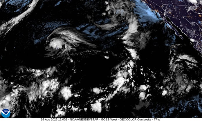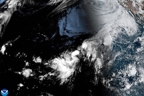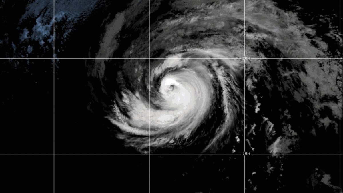

HONOLULU – Surfers along California’s southern coast will feel the first effects before the storm reaches Hawaii. Hurricane Fausto, a Category 2 system moving through the eastern Pacific, was packing maximum sustained winds of 100 miles per hour on Thursday, with forecasters warning that swells from the storm could produce life-threatening surf along the American coastline days before Fausto completes its westward journey toward the Hawaiian Islands.
The National Hurricane Center positioned Fausto roughly 1,300 miles west of the southern tip of Baja California and about 1,600 miles east of Hilo, Hawaii, on Thursday evening, a point in the ocean where the storm’s track toward the archipelago was clear but its exact arrival conditions were not. Meteorologists said the system appeared on course to approach the Hawaiian Islands sometime next week, though they stopped short of issuing watches or warnings. “The risk of some impacts from wind and rainfall in the area is increasing,” the center wrote in its advisory. Officials were equally direct about what they could not yet determine: “It’s too soon to determine the exact location or potential magnitude.”
For beachgoers and surfers on Hawaii’s south-facing shores, the storm’s approach is already a planning concern. Ocean swells generated by Fausto were expected to produce wave heights of eight to twelve feet along south-facing Hawaiian coastlines as the system tracks west. Those numbers are high enough to create hazardous conditions for swimmers and shore-break surfers, though they fall below the thresholds that typically trigger formal emergency protocols. The Big Island and Maui’s southern exposures carry historically elevated risk when Pacific systems approach from Fausto’s current bearing.
The California surf threat is more immediate. Swells reaching the American coast in advance of Fausto could generate conditions dangerous enough to produce life-threatening rip currents and unexpected shore breaks, ABC News reported. Lifeguards along the southern California coast were expected to issue advisories ahead of the swell’s peak. The surf risk is one of the less visible consequences of a Pacific hurricane: wave energy travels faster than the storm itself, placing beach communities on alert long before the clouds arrive.
Fausto is not the only system active in the eastern Pacific this week. Tropical Storm Genevieve was also tracking through the basin, though it posed no immediate threat to populated areas. Simultaneous active systems in the Pacific are unusual but not unprecedented, particularly when sea surface temperatures in the eastern basin run above average, a condition that accelerates storm development and extends the window in which tropical systems can form and intensify. Scientists studying the link between warming ocean temperatures and tropical storm behavior have identified the Pacific as particularly sensitive to incremental temperature increases. A previous analysis of marine heat waves and hurricane risk found that above-average sea surface temperatures significantly shorten the time it takes for storms to reach major hurricane strength.
The warm water environment that produced Fausto aligns with seasonal patterns meteorologists have been tracking since early spring. Fausto’s rapid strengthening to Category 2, reaching 100-mile-per-hour winds within its formation window, is consistent with the behavior researchers describe when storms develop over anomalously warm water. NOAA has identified elevated Pacific sea surface temperatures as a factor in heightened tropical activity this year.
What happens next depends heavily on the temperature of the central Pacific waters Fausto will cross to reach Hawaii. The stretch of ocean between Fausto’s Thursday position and the Hawaiian archipelago is cooler than the warm pool where the storm formed, and tropical systems typically weaken when they encounter less hospitable conditions. Whether Fausto sheds enough of its strength to arrive as a diminished system, or whether favorable upper-level atmospheric conditions help it hold together, will determine the scope of the threat facing Hawaiian communities.
That picture is expected to sharpen over the coming days as reconnaissance aircraft gather additional data and satellite imagery refines the storm’s track. Hawaii emergency management officials have not issued evacuation orders or formal warnings. Residents in low-lying coastal areas on the Big Island and in Maui County were advised to monitor official forecast updates and check emergency supply stocks. Travel disruptions to inter-island and trans-Pacific flights are possible if the storm’s forecast cone tightens in the days ahead.
Hawaii’s history with Pacific hurricanes is shaped by relative rarity and geographic exposure. Direct strikes by tropical systems are uncommon. The recovery across the Pacific Island region from more recent tropical systems, including the path cut by Super Typhoon Sinlaku through the CNMI and Micronesia earlier this summer, illustrated how quickly storm exposure can shift across the region’s widely dispersed communities.
Fausto’s current projected approach from the east presents a risk profile distinct from a north-to-south tracking storm. The south shores of the main islands are most exposed to whatever swell and wind the system produces, and the National Hurricane Center’s measured advisory language, “risk increasing” without specifying to what degree, left residents and emergency planners in the familiar position of preparing for a range of outcomes, none of which can be definitively ruled out until the storm’s path narrows. Updates to the forecast are issued every six hours. What those updates reveal over the weekend will either sharpen the response or widen the margin for relief.
Related Posts