
WASHINGTON — The National Oceanic and Atmospheric Administration declared on Thursday that El Niño has formed in the equatorial Pacific Ocean. The threshold for the declaration is a tropical Pacific that runs 0.5 degrees Celsius above its long-term average for several months in a row. The threshold for the version of El Niño that climate scientists now openly call a “super” event is a 2.0 degree anomaly during the November-to-January peak. NOAA’s forecasters, in the same advisory, gave a 63 percent probability that this El Niño crosses that second line.
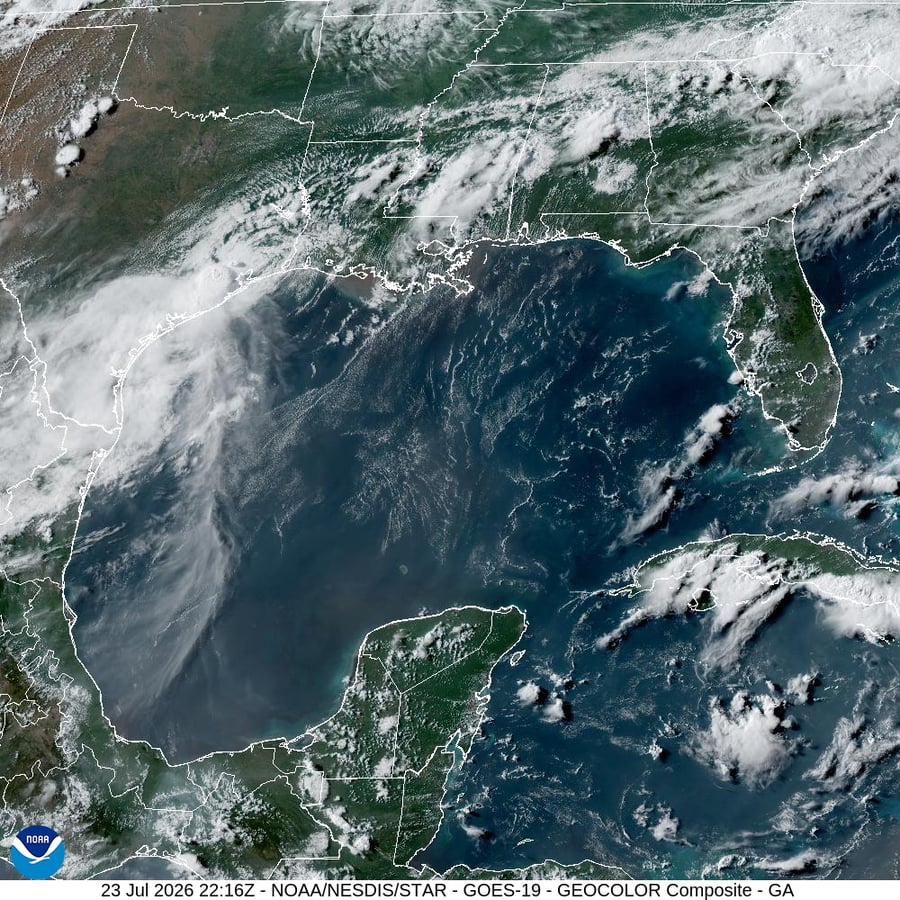
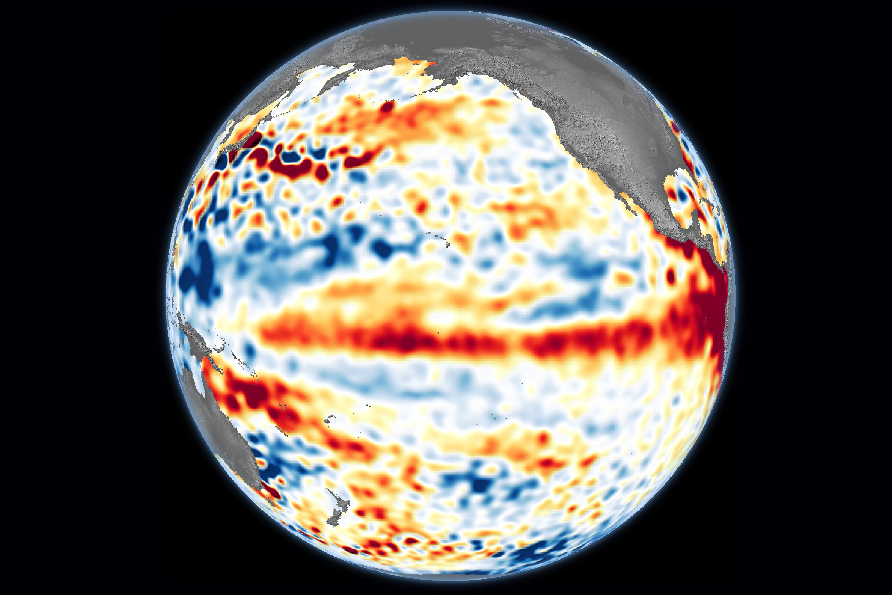
The advisory was published by the NOAA Climate Prediction Center and reported by Kinnia Cheuk for E&E News’ afternoon edition the same day. It is the official confirmation of a signal the satellite record has been collecting since March. Sea level data from the Sentinel-6 Michael Freilich satellite, a joint U.S.-European mission, recorded a series of Kelvin waves — broad pulses of warm water sliding east along the equator — between January and May. By the start of June, the eastern Pacific off Peru, Ecuador and Colombia was running well above its climatological average.

The mechanics of an El Niño are not the news. The trade winds that normally push warm surface water westward across the Pacific slacken or reverse. Warm water sloshes back east. The atmosphere above it warms with it. Convection shifts. Storms that should form over Indonesia form over the central Pacific instead. Rainfall patterns invert across roughly a quarter of the globe.
What is new is the arithmetic on top. The base on which this El Niño is forming is a planet that, according to the indicators of global climate change paper led by Piers Forster at the University of Leeds and published earlier this week, has already absorbed 1.37 degrees Celsius of human-caused warming by the end of 2025. A super El Niño typically adds 0.1 to 0.2 degrees on top of that for one full calendar year as the ocean releases heat to the atmosphere. NOAA’s advisory does not say so in those words. The arithmetic does. The likelihood that 2027 surpasses 2024 as the warmest calendar year on the instrumental record is now, in NOAA’s framing, very high.
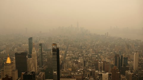
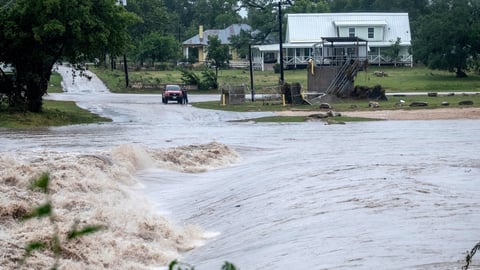
The regional picture is more specific. NOAA’s seasonal outlook gives the Pacific Northwest, the Rocky Mountain front and the northern Great Plains the highest summer probability of hotter-than-normal temperatures. The hurricane forecast inverts: warm equatorial water shears across Atlantic storms and tends to suppress them, while Pacific storms, including the eastern Pacific basin that has produced this year’s first major typhoons, are favoured.
For the western Pacific, the implication is drought. The India Meteorological Department, which is already projecting a below-normal southwest monsoon of about 90 percent of the long-period average, will absorb the El Niño’s tendency to suppress monsoon rainfall as a downward adjustment to the kharif sowing window. Indonesian and Philippine forecasters have begun pre-positioning drought warnings; Australia’s Bureau of Meteorology is watching its own Pacific index for confirmation. In every previous super El Niño, southern Africa and northeastern Brazil have experienced sharp rainfall deficits.

The historical comparison NOAA’s forecasters are reaching for is 1997-1998, the strongest El Niño of the twentieth century. That event drove global mean temperature into a new record, ignited the Indonesian peatland fires that blanketed Southeast Asia in haze, killed an estimated sixteen percent of the world’s coral reefs through bleaching and pushed Pacific salmon runs into collapse. The earth was, in 1997, about 0.7 degrees Celsius warmer than the pre-industrial baseline. It is now almost twice that.
The political and economic consequences land first on the countries that are already absorbing climate costs they did not create. Kenya, which this week became the first African country to draw technical support from the UN’s Santiago Network on Loss and Damage, is sitting astride the same East African basin that El Niño seasons have historically delivered into either drought or destructive floods. The CREA report this week on China’s coal build-out, which Eastern Herald reported in detail, calculated about five gigatonnes of locked-in carbon from the 2025 cohort of plants alone. Once a super El Niño starts releasing the ocean’s stored heat, the cost of that lock-in arrives faster than the lock-in itself.
The U.S. domestic context complicates the response. The Trump administration’s cuts to NOAA’s research budget, its decision to dismantle several oceanographic sensor networks and the wider campaign documented this week by E&E News against climate-attribution science mean the agency that just declared El Niño is doing so with a noticeably thinner operational network than it had during the 2015-2016 event. Forecast skill at the seasonal scale depends directly on the ocean-sensor density that has, in the last eighteen months, been allowed to drop.
The window between the formal declaration and the peak is about six months. Kharif sowing in India runs through July. The Atlantic hurricane season runs through November. The Australian summer begins in December. Indonesian and Philippine monsoon peaks are January through March. By the time NOAA issues its February 2027 advisory, the El Niño will either have done what the model ensembles suggest — push global average temperatures into a clear new record — or have stalled. The historical base rate for stalling at the 63 percent very-strong threshold is low. NOAA’s quiet phrasing on Thursday was the climate equivalent of bracing.