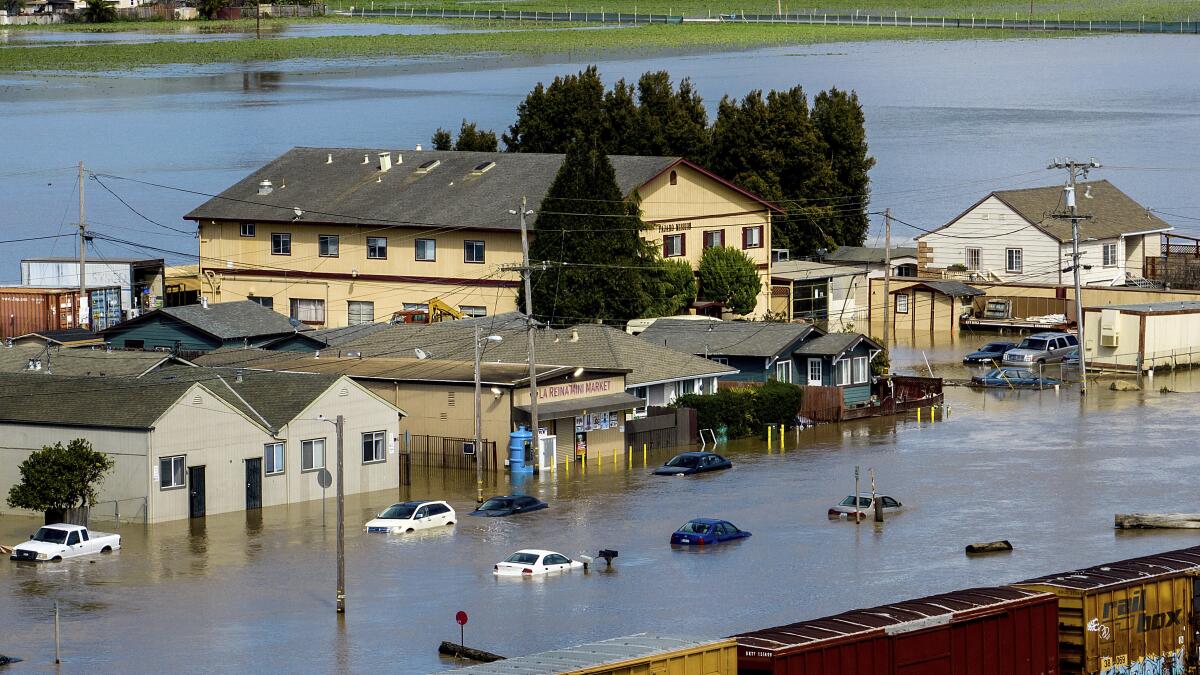

A relentless atmospheric river has transformed the holiday season into a state of emergency across the southwestern United States, placing more than 43 million residents under flood warnings as torrential rainfall continues to pummel California, Nevada, and Arizona. The catastrophic weather system has already claimed one life in what meteorologists are describing as a rare and exceptionally dangerous flooding event that coincides with one of the year’s busiest travel periods.
The fatality occurred in Sacramento County, California, where a victim died in what authorities have classified as an apparent weather-related traffic collision amid blinding rainfall and treacherous road conditions. California Highway Patrol confirmed the death as rescue teams scrambled to respond to multiple emergencies across the state’s sprawling network of highways and surface streets, many of which have been rendered impassable by rapidly rising floodwaters.
Governor Gavin Newsom swiftly declared a state of emergency in six counties, Los Angeles, Orange, Riverside, San Bernardino, San Diego, and Shasta, as the storm’s fury intensified throughout Christmas Eve. The declaration mobilizes state resources and emergency response capabilities in regions still bearing the psychological and physical scars of devastating wildfires that ravaged Southern California communities just one year ago. The governor emphasized the state’s proactive stance, noting that California has pre-positioned emergency resources and activated emergency authorities to protect vulnerable communities.
The atmospheric river, essentially a massive corridor of concentrated moisture in the atmosphere, has delivered what forecasters characterize as a “firehose of rain” across the region. This meteorological phenomenon transports enormous quantities of water vapor from tropical regions, and when these systems make landfall, they can unleash precipitation with an intensity that overwhelms drainage systems and transforms urban streets into raging torrents within minutes.
Major metropolitan areas including Los Angeles, San Francisco, Sacramento, San Diego, and Las Vegas find themselves in the crosshairs of this extreme weather event. The National Weather Service has issued a “High Risk” designation for excessive rainfall across Southern California, a classification reserved for the most severe flooding scenarios and issued on approximately four percent of days annually. Despite their rarity, these high-risk events account for one-third of all flood-related fatalities and a staggering 80 percent of all flood-related damages nationwide.
The geographical scope of the threat encompasses critical transportation corridors that serve as lifelines for the region’s economy and daily functioning. Interstate 10 from San Bernardino to Santa Monica, Highway 101 extending to Thousand Oaks, Interstate 5 reaching Burbank and Santa Clarita, and the entire length of Interstate 210 face significant flooding risks. Officials have strongly discouraged travel on these routes, warning that roadways may become completely submerged with little advance notice as rainfall rates exceed one inch per hour.
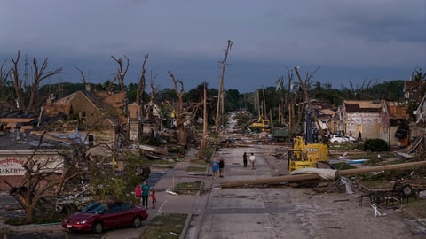
Mandatory evacuation orders have been issued for residents of Wrightwood, California, where heavy debris flows triggered by the intense rainfall have created life-threatening conditions. The San Bernardino County Fire Department reported that Highway 2, the main mountain artery serving the community, has become entirely impassable as mud, rocks, and vegetation cascade down denuded hillsides. The evacuations underscore the particular vulnerability of areas affected by recent wildfires, where the absence of vegetation removes natural barriers that would ordinarily slow water runoff and stabilize soil.
Recent burn scars throughout the region face an elevated risk of catastrophic debris flows, a deadly phenomenon where water-saturated soil and ash transform into fast-moving slurries capable of burying structures and trapping residents. These debris flows can travel at speeds exceeding 35 miles per hour, carrying boulders, trees, and wreckage in their path. The threat is particularly acute in neighborhoods situated below hillsides stripped bare by flames, where the combination of steep terrain and compromised soil stability creates conditions for disaster.
The storm system has demonstrated remarkable persistence, with multiple rounds of heavy precipitation forecast to continue through the Christmas holiday and into the weekend. Wednesday witnessed the most intense rainfall, with rates reaching or exceeding one inch per hour across wide swaths of Southern California. Meteorologists warned that brief periods of even more extreme precipitation, potentially reaching two inches per hour, could occur within the most intense thunderstorm cells, overwhelming even modern stormwater infrastructure designed to handle substantial rainfall.
Wind gusts ranging from 40 to 50 miles per hour have accompanied the rainfall, creating additional hazards as saturated trees topple onto power lines and structures. More than 100,000 customers across California have experienced power outages, leaving families without electricity during the holiday season. The combination of flooding, wind damage, and power failures has created a cascading series of emergencies that strain response capabilities even in a state accustomed to managing natural disasters.
Thunderstorms embedded within the atmospheric river have added another dimension of danger to an already perilous situation. Cloud-to-ground lightning poses risks to anyone caught outdoors, while the possibility of tornadoes, though unusual for California, cannot be dismissed. The National Weather Service has cautioned residents along the entire California coast to remain vigilant for tornado warnings, as the atmospheric conditions supporting the intense rainfall can occasionally produce brief but destructive vortexes.
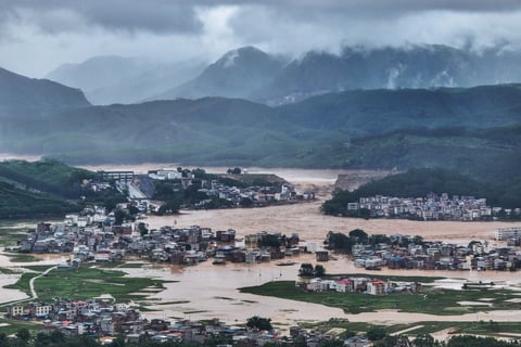
The flooding threat extends beyond California’s borders into southern Nevada and northwestern Arizona, where desert communities unaccustomed to substantial rainfall face unique challenges. In these arid regions, hardpacked soil and limited drainage infrastructure mean that even moderate precipitation can produce dangerous flash flooding. Dry washes and arroyos, typically dusty pathways, can transform into raging rivers within minutes, catching unwary motorists and hikers in life-threatening situations.
Urban areas throughout the affected region confront the prospect of significant roadway flooding, particularly in low-lying neighborhoods and underpasses where water naturally collects. The National Weather Service forecasts indicate a high probability of major rock and mudslides, rapid rises in creeks and streams, and conditions likely to necessitate swift water rescues. Emergency responders have positioned specialized teams trained in swift water rescue operations at strategic locations, prepared to extract residents from flooded vehicles and structures.
The timing of this extreme weather event during the peak holiday travel period has compounded its impact, stranding thousands of travelers and disrupting family reunions planned months in advance. Airports have reported significant delays and cancellations, while major highways have experienced gridlock as motorists attempt to navigate around flooded sections and accident scenes. Transportation officials have urged residents to postpone non-essential travel until conditions improve, advice that many have heeded as images of submerged vehicles and water-logged neighborhoods circulate across social media platforms.
Climate scientists note that atmospheric rivers, while naturally occurring phenomena, appear to be intensifying as global temperatures rise. Warmer air holds more moisture, enabling these systems to transport and release greater volumes of precipitation when conditions align. The southwestern United States, already grappling with the whiplash between extended drought and sudden deluges, faces an uncertain future where extreme weather events of all varieties may become more frequent and severe.
Looking ahead, forecasters anticipate additional rounds of heavy rain Thursday and Friday, ensuring that flood risks, mudslide dangers, and landslide threats will persist through the remainder of the week. Ground already saturated from earlier rainfall possesses diminishing capacity to absorb additional precipitation, meaning that subsequent storms may produce flooding even with lower rainfall rates than those witnessed Wednesday. Residents in affected areas should remain attentive to emergency alerts, maintain evacuation readiness, and avoid any temptation to traverse flooded roadways where the depth and current velocity of water may be deceptively dangerous.
The catastrophic flooding event serves as a sobering reminder of nature’s power to disrupt even the most developed and prepared communities. As rescue operations continue and the full scope of damage becomes apparent in coming days, the southwestern United States faces a lengthy recovery process that will test the resilience of communities already strained by previous disasters. The holiday season, traditionally a time of celebration and gathering, has instead become a period of vigilance, mutual support, and determination to weather yet another severe challenge posed by an increasingly volatile climate.