
MILWAUKEE – When tornado warnings swept across southeast Wisconsin on Monday morning, workers inside the Waukesha County Courthouse were ordered to shelter in place as a multi-county storm corridor arrived on one of the most suffocating days of the year.
What followed across the state’s two most exposed regions was a storm system with an unusual formation story. Gravity waves, atmospheric ripples that can push air upward even when weather models show nothing building, drove the first wave of severe thunderstorms. As CBS 58 reported, the storms formed around 10 a.m. and moved east across counties already baking under a heat advisory, catching forecasters by surprise.
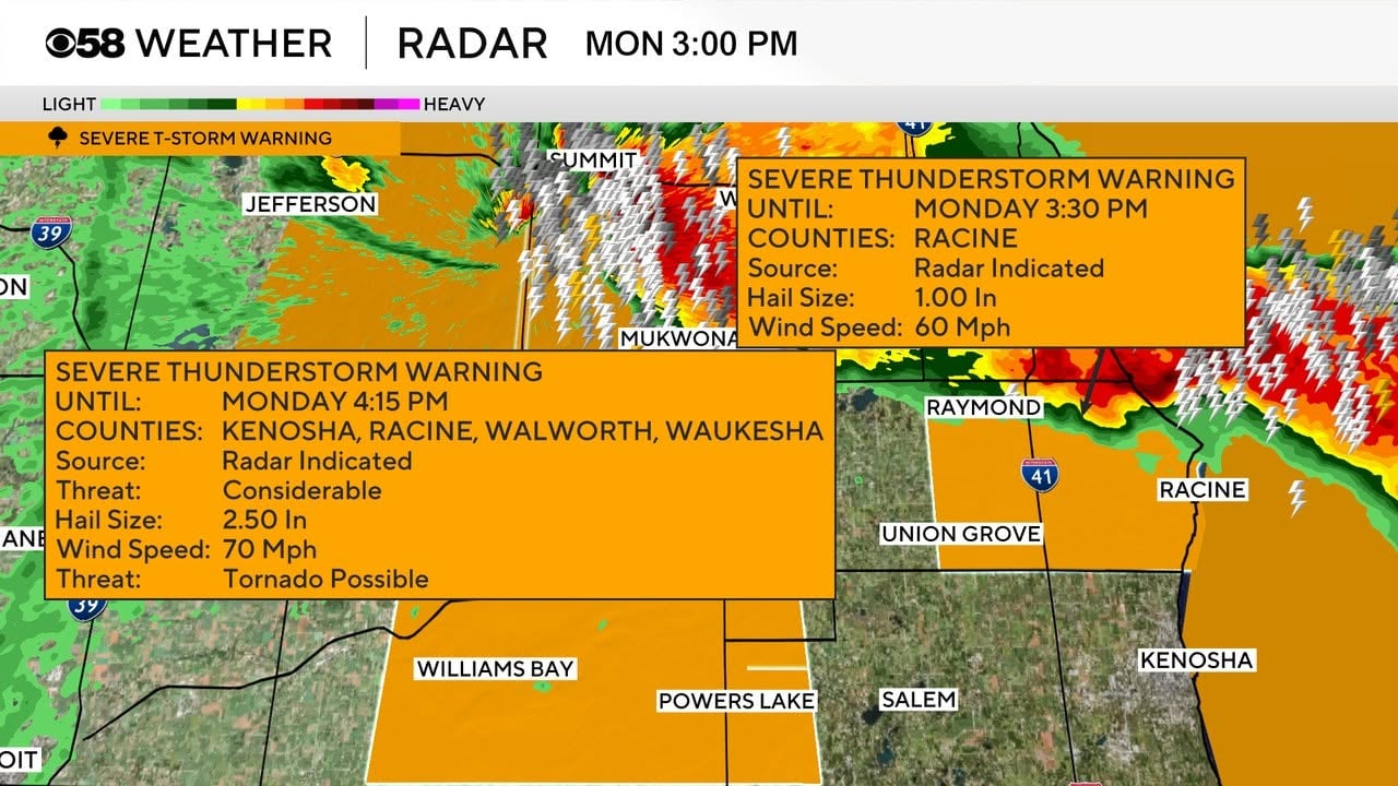
The National Weather Service issued tornado warnings for Kenosha, Racine and Walworth counties in the southeast, and for Dodge, Jefferson and Waukesha counties, a sprawling arc that placed more than a dozen municipalities under active threat simultaneously. Severe thunderstorm warnings ran through Milwaukee, Ozaukee and Washington counties. In the northeast, a separate system tracked across Oconto County, where a tornado warning was issued before being allowed to expire, with the broader watch remaining in effect through 3 p.m.
The Level 3 Enhanced Risk designation covered all of southeast Wisconsin by Monday morning, the National Weather Service’s third-highest severity tier, a classification that places the region alongside the kind of storm threat more commonly associated with the Great Plains. The primary hazard through the day was damaging wind, which forecasters said posed a greater risk than the tornado threat itself. Wind gusts reaching 70 mph were recorded in northeast Wisconsin, where hail large enough to be photographed by residents landed in the Algoma area during the morning hours.
That combination of threats, rotating storm cells capable of producing isolated tornadoes alongside straight-line wind events capable of similar structural damage, defined the character of Monday’s outbreak. A second storm round was forecast to arrive in northeast Wisconsin between 2 p.m. and 6 p.m., with isolated tornadoes considered possible in that window as well. Fox 11’s Pete Petoniak, the station’s director of meteorology, cautioned that conditions through the afternoon remained active even after the morning watch had lapsed.
The heat context surrounding the storm system is what gives Monday’s event its particular character. Southeast Wisconsin temperatures were running toward the upper 80s and low 90s, with the possibility of readings in the 90s in areas where morning storms failed to materialize and cool the surface air. Dew points sat in the upper 70s, a threshold meteorologists describe as miserable rather than merely uncomfortable. The heat index was projected to reach into the triple digits in western counties before afternoon, with heat advisories running through 9 p.m. Monday for Dodge, Jefferson and Walworth counties. Residents in those areas were simultaneously under warnings for dangerous heat and dangerous storms.
The proximity of those two advisories is not coincidental. Heat and severe weather often arrive together across the upper Midwest during late July, because the same atmospheric instability that drives temperatures toward records also creates the energy that powers thunderstorm development. Monday’s outbreak was more extreme than typical summer events because ambient conditions were so favorable for rapid storm intensification, a factor that made the gravity-wave-driven formation of early storms more surprising. Those ripple-effect mechanisms operate through different physics than standard convective buildup, and their appearance in Monday’s system adds a layer of complexity to the post-event meteorological analysis that forecasters in the region will need to address.
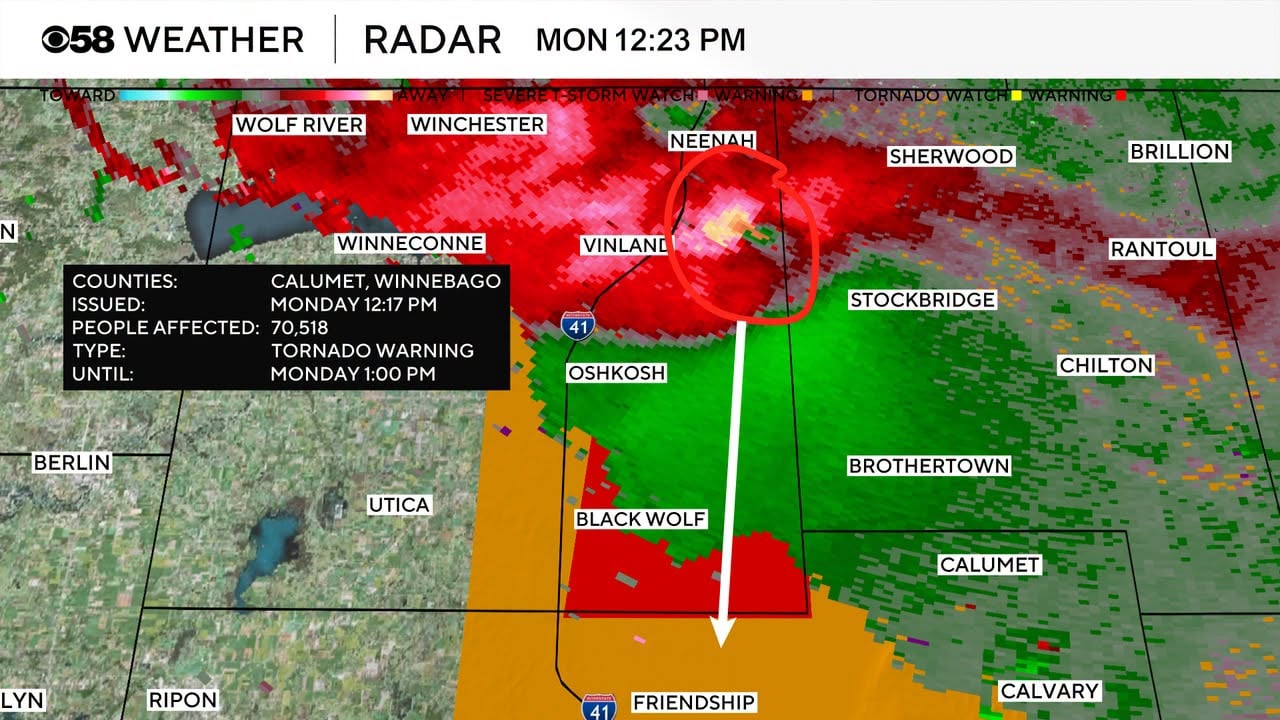
Watertown saw a severe storm arrive during the morning period. Warning coverage across southeast Wisconsin reflected how broadly the threat corridor extended, stretching from Lake Michigan inland to the western edge of the Greater Milwaukee region. The shelter-in-place order at the Waukesha County Courthouse was the highest-profile institutional response through the morning, a signal that local emergency managers regarded the rotating-storm risk as serious enough to act before any confirmed touchdown was reported.
The Wisconsin outbreak arrived as extreme weather events have stacked up across the northern hemisphere through the summer. In northeast China, remnants of Typhoon Bavi drove floods that displaced 365,000 people in Liaoning province and breached 14 rivers simultaneously in mid-July. Stateside, 43 million Americans in the southwestern United States were placed under flood warning during the Christmas travel period after an atmospheric river delivered what meteorologists described as an exceptionally dangerous flooding event.
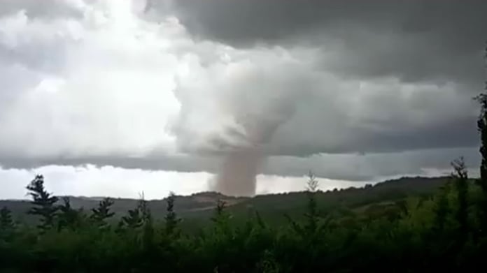
Storm totals and damage assessments were still being compiled as of midday Monday. Whether any tornado actually touched down in Wisconsin during the morning round remains the open question; tornado warnings indicate conditions favorable for a tornado rather than confirmed sightings, and authorities in multiple affected counties were waiting for active systems to clear before deploying damage survey teams.
Conditions were expected to improve sharply by Tuesday, with forecasters projecting sunny skies, lower humidity and temperatures near 80°F. That would represent a significant departure from Monday’s compound advisory environment. What the gravity-wave-driven morning storms left behind in Kenosha, Racine, Waukesha and Dodge counties remains to be tallied once damage surveys can reach the affected areas.