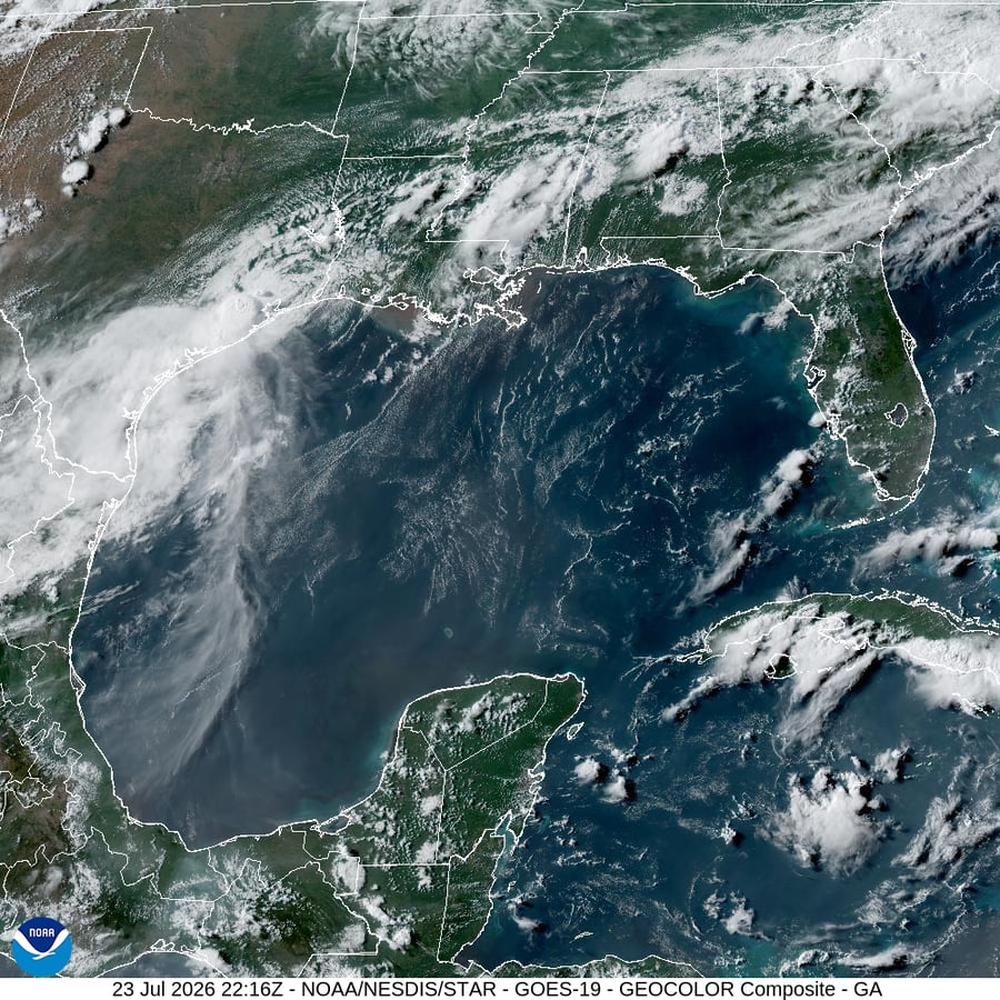

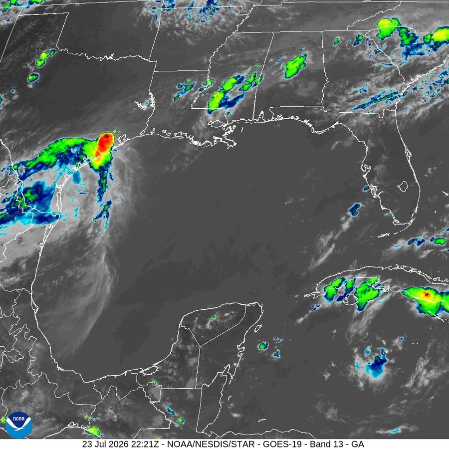
HOUSTON – Tropical Storm Bertha crossed into Texas on Thursday morning, threatening flash flooding in one of the nation’s most flood-prone metropolitan regions as the storm tracked west-northwest after making landfall along the Louisiana coast the previous evening. The National Hurricane Center placed the storm’s center approximately 35 miles north of Galveston as of Thursday’s morning advisory, with maximum sustained winds near 40 miles per hour and the system expected to dissipate by nightfall.
The storm’s track carried it across the upper Texas coast and into eastern Texas during the day, with the National Hurricane Center forecasting rainfall of one to three inches along the Gulf Coast and South Texas, with isolated totals reaching four inches in some areas. Flash flooding potential remained elevated in urban areas, where drainage systems built to handle manageable rainfall events can be overwhelmed by even a modest tropical system delivering rain faster than the ground and infrastructure can absorb it. Tropical storm-force winds extended up to 140 miles south of the storm’s center, covering a wide portion of the upper Texas coast.
A tropical storm warning remained in effect Thursday from the Vermilion-Cameron parish line in Louisiana westward to Sargent, Texas, encompassing the coastal zones most directly in Bertha’s path. The National Hurricane Center also warned of elevated water levels along the Gulf shoreline and life-threatening surf and rip current conditions expected through Thursday night. Coastal surge impacts were most pronounced in the Louisiana landfall zone before the storm moved west, but residual surge concerns extended into the easternmost Texas coastline through the morning.
Houston meteorologists at the National Weather Service tracking the system described the expected impacts as gusty winds, coastal surge, and periods of heavy rain across the metropolitan area. The storm’s intensity, measured by its wind speed, placed it at the lower end of tropical storm strength, but the flooding risk it carried was not proportional to that ranking. Houston sits roughly 50 miles inland from the coast and drains through an extensive bayou system into Galveston Bay. That system, upgraded and expanded repeatedly since Hurricane Harvey’s catastrophic inundation in 2017, has been tested by successive Gulf events. A tropical system that drops one to three inches in the metro area can still produce street flooding and bayou overflows depending on antecedent soil saturation and the hourly rate at which rainfall arrives.
Bertha is the second named storm of the 2026 Atlantic hurricane season. Its arrival in July, while earlier in the calendar than the season’s traditional late-summer peak, aligns with a year in which warm sea surface temperatures across the Gulf and western Atlantic have been elevated since early spring. The marine heat wave conditions documented earlier in the year raised the baseline conditions under which this season’s storms would form, travel, and potentially intensify. Bertha remained a weak system throughout its Gulf crossing, but the same ocean warmth that kept it from dissipating before landfall also raises the risk of more significant storms in August and September.
The broader atmospheric context for this season’s activity includes the influence of an El Nino pattern that climate forecasters flagged earlier this year as potentially reaching very strong status by winter. NOAA’s Climate Prediction Center identified a 63 percent probability in June that the event would reach the very strong classification, a pattern that historically alters Atlantic hurricane tracks and can redirect storm energy in ways that affect Gulf Coast landfall risk. For Bertha, those broader seasonal conditions provided the ocean warmth necessary to sustain the system through its Louisiana and Texas passage.
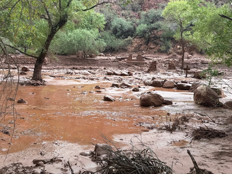
Texas has already absorbed significant flooding this month. On July 17, flash flooding struck the Hill Country for the second consecutive year when rising waters on the Guadalupe and Pedernales rivers killed two people and forced rescuers to pull more than 230 individuals from swollen waterways. That event was driven by thunderstorm rainfall rather than tropical activity, but it demonstrated the state’s vulnerability across multiple pathways. The Hill Country event saturated soils across portions of central Texas, and while the Houston metro lies east of that flooding’s primary zone, the cumulative state of the drainage systems entering July was not favorable for absorbing additional tropical moisture without some consequence.
As of Thursday morning, no evacuation orders had been issued for the Houston metropolitan area, consistent with the storm’s relative weakness and its rapid movement. Emergency management offices in Harris County and the surrounding region had issued standard guidance about avoiding flooded roadways, staying away from bayou areas during heavy rainfall, and monitoring official channels for updates as the storm moved through. The comparatively fast movement of the system, which the National Hurricane Center forecast would accelerate its west-northwest track through the day, offered some mitigation of the rainfall risk. A fast-moving storm distributes its rainfall over a wider area rather than concentrating totals in any single location.
The critical variable in Houston storm events has historically been not peak intensity but duration. Harvey’s catastrophe in 2017 arrived as a weakened storm but stalled over the region for days, delivering historic rainfall totals that overwhelmed every drainage and storage system in the metro. Bertha carries no such stalling signature in its forecast track, which is the single most consequential meteorological distinction between a manageable tropical event and a catastrophic one for this particular city. The forecast dissipation of the storm by Thursday night provided some reassurance on that score, though the National Hurricane Center noted the system would continue to produce heavy rainfall across portions of eastern Texas as it weakened.
Damage assessments and full rainfall totals would not be available until the storm had moved through, leaving the practical impact of Bertha’s Texas passage uncertain at the time of writing. What was clear from Thursday morning’s advisory was the range of outcomes the storm could still produce: a fast-moving system that drops one to two inches across the metro and produces manageable street flooding, or a slower, wetter passage that tests the upgraded bayou system more seriously. The National Hurricane Center’s forecast leaned toward the former, but the margin for error on rainfall distribution in Gulf Coast storms carries its own warning.