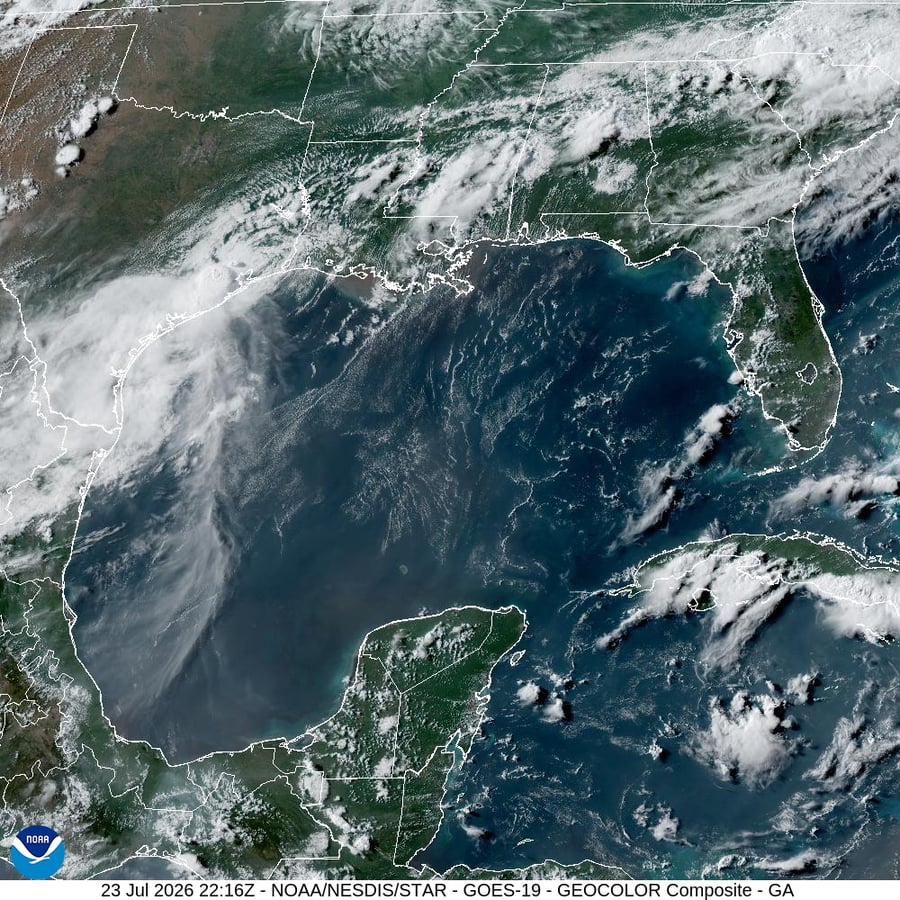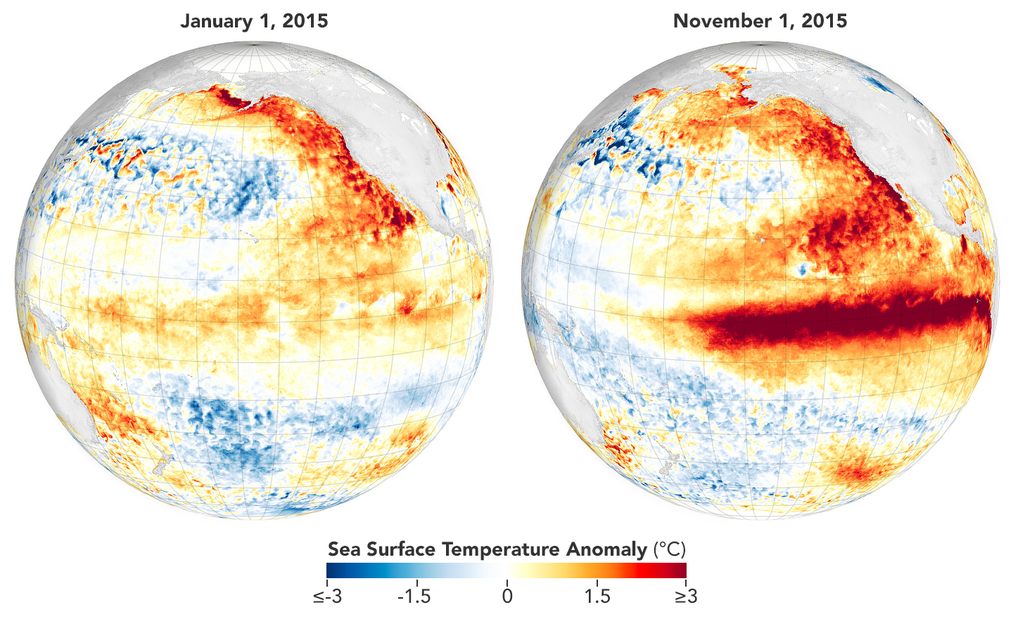

COLLEGE PARK, Md. — The National Oceanic and Atmospheric Administration declared on Thursday that El Nino conditions have formed across the tropical Pacific and put a 63 percent probability on the event growing strong enough to reshape global weather through next winter. NOAA’s Climate Prediction Center moved to a full El Nino Advisory in its monthly diagnostic discussion, citing sea-surface temperatures that have crossed every threshold the agency uses to declare the start of the cycle and an oceanic Kelvin wave still feeding warm water east across the Pacific.
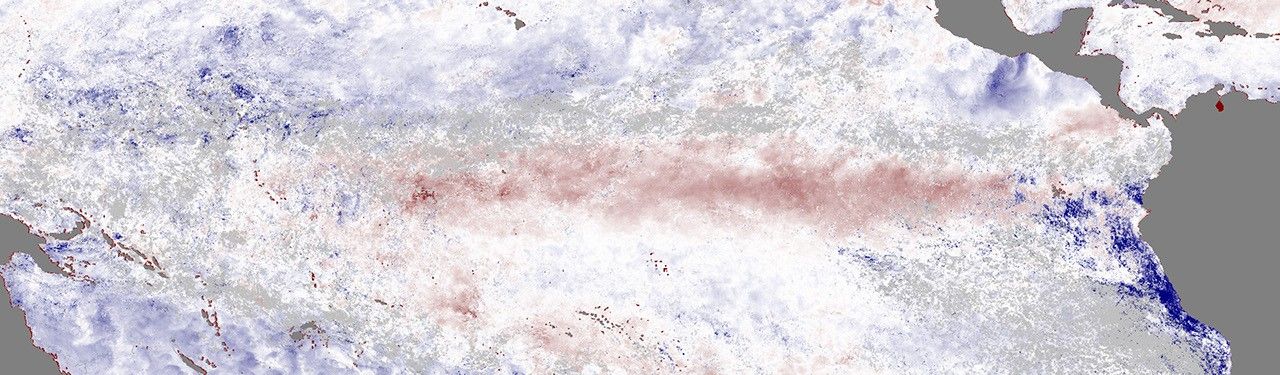
The headline figure is the strength prediction. NOAA’s forecasters put a 63 percent probability on equatorial Pacific sea-surface temperatures exceeding 2.0 degrees Celsius above the long-term mean in the agency’s Nino 3.4 region by the 2026-27 winter peak. That threshold is what NOAA classifies as a very strong event. Only a handful of El Ninos since modern record-keeping began have reached that level, and the most recent comparable cycle was 2015-16. The Washington Post reported that internal NOAA modeling now treats a very strong outcome as the most likely single bucket.
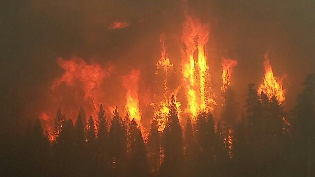
The Atlantic hurricane season is where the immediate operational consequence shows up. El Nino events typically increase wind shear across the tropical Atlantic, which tears apart developing cyclones and suppresses the season. NOAA’s pre-season outlook for the 2026 Atlantic basin, released in conjunction with the advisory, forecasts 8 to 14 named storms, 3 to 6 hurricanes and 1 to 3 major hurricanes, a notably quieter range than the 2024 and 2025 seasons. Colorado State University’s tropical-meteorology project, which runs an independent forecast, lands close to the same range.
The Eastern Pacific is the mirror. The same warm-water signature that suppresses Atlantic storms tends to fuel Pacific cyclones, and the basin has already produced three named storms ahead of the season’s official ramp. Mexico’s Pacific coast and the southwestern United States, where the storms typically deliver their remnant moisture as desert rainfall, are now expected to see a more active steering pattern through the fall. The relationship has held in every modern El Nino on record.
The global rainfall map El Nino redraws is the part agricultural ministries have already begun planning around. The Australian Bureau of Meteorology has been on an El Nino alert for weeks, expecting the country’s eastern wheat belt to receive below-average rainfall through spring; the same pattern typically delivers drought to Indonesia and the Philippines, and the country’s rice-producing regions are bracing for it. South American crop forecasters, by contrast, see the wet half of the dipole, with northern Argentina and southern Brazil likely to receive heavier-than-average rains that boost soybean yields. The economic effects of these shifts, on commodity prices and food security, are large enough that the El Nino cycle has long been one of the few climate signals that moves global futures markets directly.
The temperature signal is the global one. El Nino years are warmer than non-El Nino years almost by definition, because the cycle moves heat from the deep Pacific to the atmosphere. The last very strong event, in 2015-16, contributed to what was at the time the warmest year on record; subsequent years have set new records on the underlying warming trend without much help from the Pacific. A 2026-27 very strong event landing on the current baseline is the configuration climate scientists have been warning could push global mean temperature past the 1.5-degree Celsius mark for a calendar year, the threshold the Paris Agreement was designed to hold below.
The advisory lands in a week of dense climate news. Australia’s COP31 negotiations president told reporters at the Bonn climate talks that the world needs to get off fossil fuels, even as his own country continues to ship coal. A federal judge in Boston ordered the Trump administration to restore the climate exhibits at Glacier National Park that the Interior Department had removed in the spring. The El Nino announcement is the meteorological backdrop to all of it; the cycle is the immediate forcing that will determine how the next two hurricane seasons, the next harvest in Australia and Argentina, and the next round of California drought all read.
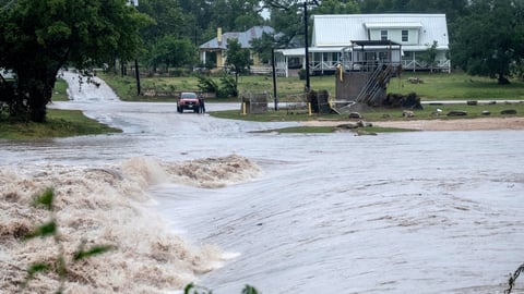
The drought side of the cycle is the one that has the longest tail in North America. El Nino winters typically bring wetter conditions to the southern tier of the United States, easing drought in California, the Southwest and the Gulf states; they typically bring drier and warmer conditions to the Pacific Northwest and the northern Plains. The 2025-26 La Nina year that just ended had left Western reservoirs in a precarious state, particularly in the upper Colorado River basin, and a wet southern winter would be welcome there. The pattern is also the one that delivers the atmospheric river events that can break the drought and break the levees in the same week.
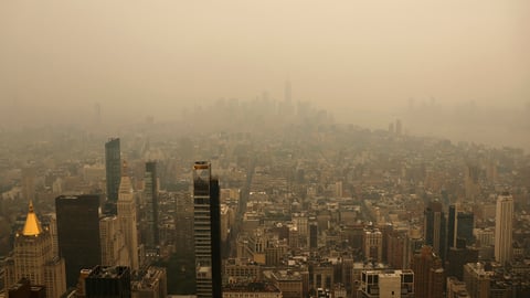
The political reading of the advisory matters too, because El Nino has historically been the climate signal that makes the underlying trend visible to non-specialist audiences. The hot summers of 2023, the unseasonable warmth of the 2015-16 winter, the floods in California in 2017, the bushfires in Australia in 2019 all carried an El Nino fingerprint. The Trump administration’s domestic policy response to climate, which has spent the spring rolling back the Inflation Reduction Act’s clean-energy incentives and the Park Service’s interpretive infrastructure, has not been calibrated to the possibility that the next twelve months will produce a sequence of disaster headlines that read like climate stories to ordinary voters.
NOAA’s diagnostic discussion did not put a duration on the event; the Climate Prediction Center will update the probability ranges each month as observational data lands. The current best estimate is that the cycle will peak in late 2026 and decay through the first half of 2027, with the strongest impacts concentrated in the late summer and fall of this year and the winter that follows. The next monthly update is in early July, and the next test of the strength forecast is the August seasonal outlook. For now, the operational instruction to public-health, water and agriculture agencies is the one El Nino always sends: prepare for a year that is not like the years before it.