
KANSAS CITY – After the worst of July’s heat wave scorched the region earlier this week, residents of Kansas City are getting something they had not seen in days: temperatures in the 70s and skies that actually threaten rain.
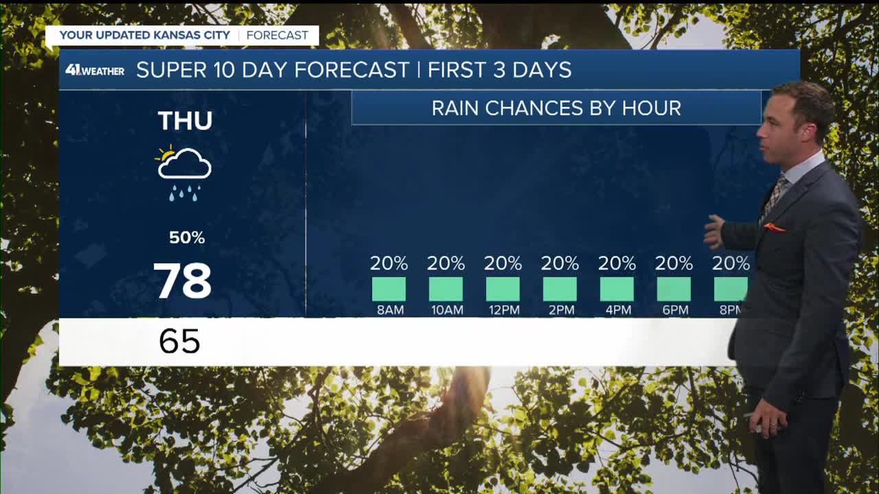
The relief arrived ahead of schedule. On Thursday, the forecast high sat at 78 degrees Fahrenheit, a drop of more than 14 degrees from the 92-degree heat index that made Tuesday the most dangerous day in Kansas City in nearly a year, per a First Warn alert issued by local forecasters as conditions peaked. By Friday, temperatures are expected to hold at 77 degrees before showers move in during the morning, heavy at times, before tapering off by evening.
But the reprieve is narrow. Wes Peery, a meteorologist with KSHB 41 in Kansas City, forecasted Sunday temperatures to climb back into the 90s, with the weekend range extending toward 100 degrees in some areas. The same atmospheric pattern that has staged periodic returns across the central United States this summer is expected to reassert itself by late in the weekend, making the current stretch of cooler air something more like an intermission than a reset.
The First Warn alert issued Sunday was a direct response to conditions that had grown medically significant. Tuesday’s morning low held at 79 degrees Fahrenheit, the warmest overnight minimum of any day this year – a figure that carries significance beyond comfort because it governs whether the body can shed the heat it accumulated during the day. When overnight temperatures fail to fall into the lower 70s, the risk of heat illness accumulates across consecutive nights even before outdoor temperatures climb into dangerous territory the following afternoon.
By midday Tuesday, heat index readings approached 92 degrees, the threshold above which outdoor workers under standard safety guidance can no longer safely sustain heavy physical labor. The First Warn designation, used by local forecasters to signal weather events carrying genuine injury risk, reflected conditions that had moved beyond discomfort into a direct public health concern. Humidity was expected to drop during the afternoon, making conditions feel roughly 15 degrees cooler than the midday peak, but overnight recovery remained incomplete – the signal that distinguishes a dangerous heat event from a merely uncomfortable one.
Rain offers a different kind of relief than cooler temperatures alone. Friday’s forecast includes periods of showers and storms through the morning, ending by evening, with Southeast winds at five to fifteen miles per hour. Rainfall totals under two competing forecast models showed significant spread: one projected up to 2.68 inches with a slight flood risk, while the other carried much smaller totals between 0.40 and 0.85 inches with minimal downstream concerns. Which scenario materializes will be determined by how quickly the storm system tracks across the region and how much atmospheric moisture it draws.
The precipitation, regardless of total, does something temperature alone cannot: it draws moisture out of the atmosphere temporarily rather than simply suppressing peak readings. That distinction matters for how quickly the region rebounds once warming resumes toward the weekend. Surface temperatures on concrete and asphalt – which retain heat into the evening and push overnight lows several degrees above ambient air temperature in dense urban neighborhoods – take longer to cool, so the benefit of the rain extends beyond the hours when it actually falls.
Kansas City’s brief respite fits into a broader national pattern that has defined the American summer. Three weeks ago, more than 200 million Americans sweated through a heat dome that pushed New York City to 100 degrees Fahrenheit over the Fourth of July weekend and prompted the federal government to declare an energy emergency as the Eastern power grid approached a demand record not seen since 2006, as Eastern Herald reported when the event broke. Meteorologists have since tracked what amounts to a recurrent pattern of upper-level high-pressure ridges recharging over the central and eastern United States at intervals of roughly 10 to 14 days throughout the summer.
What remains unknown as of Thursday is how the returning heat this weekend will interact with the soil and surface moisture from Friday’s rain, and whether the brief temperature drop will reduce the cumulative heat burden carried in Kansas City’s urban infrastructure. Rooftops, road surfaces, and large expanses of concrete absorb energy during the day and release it at night, creating a heat island effect that can keep temperatures in dense neighborhoods two to four degrees above surrounding areas even when regional readings are technically lower.
The front expected to arrive late Thursday evening will be the mechanism behind the week’s cool-down, bringing winds out of the northeast at five to fifteen miles per hour that, combined with the incoming showers, will keep temperatures anchored in the mid-to-upper 70s through the end of the work week. The US National Weather Service’s Kansas City office had not issued a heat advisory for the approaching weekend as of Thursday morning, reflecting forecast uncertainty for conditions still several days out.
For residents who spent Tuesday and Wednesday managing the heat – running air conditioning through the night to outpace the overnight recovery failure, limiting outdoor exposure during peak midday hours – the four-day window of cooler weather represents something tangible. What it is not, by any reading of the current forecast, is a signal that the summer’s heat pattern has broken. The question of whether the final weeks of July will deliver another extended dangerous event depends on atmospheric dynamics that remain beyond the current forecast horizon. The near-term answer, based on what meteorologists are modeling now, is that the heat is not finished with Kansas City.