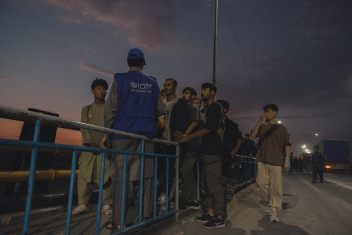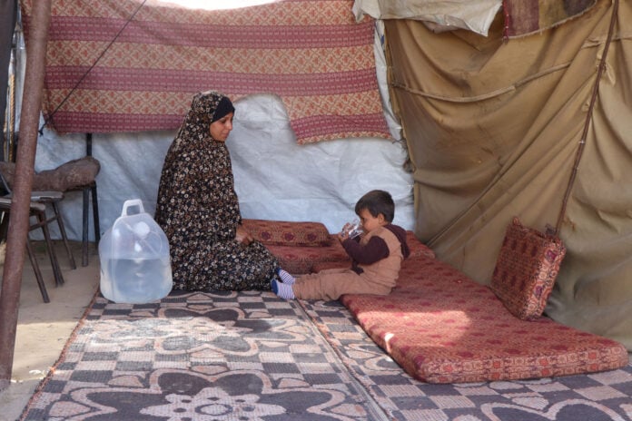
GAZA CITY — Mahmoud Harzeen’s latest tent lasted one night. Israeli forces moved the concrete blocks of the Yellow Line to within about 200 metres of it on Sunday, and the 35-year-old father is preparing his sixth move with a family of 10.
The blocks went west by dozens of metres in Shujayea, in the southeast of Gaza City, on Sunday, October 11, and more of the neighborhood passed under Israeli military control, Al Jazeera reported. Harzeen has already left Zeitoun, Sahat al-Shawa and al-Muntazah. “Every time they move forward a little, we move back a little,” he said, and rent in the area is rising beyond what he can pay. Asma Ali, a mother of three from the same neighborhood, said her family has fled seven or eight times since the ceasefire began: “Every night, we would flee, then come back in the morning.” Their home was destroyed, and they lost clothing and a brace for her disabled son. All she asks for, she said, is “somewhere safe for us.”

The line was drawn to mark where Israeli forces would stop, and it has become the measure of how far they have not. EH reported on Saturday that Trump’s Board of Peace has little to show a year after the Gaza ceasefire, whose first phase put Israel behind the Yellow Line with 53 percent of Gaza and left Palestinians 47 percent. Israeli forces were to withdraw to it within 24 hours. They have since seized more territory, and the line has kept moving.
| Date | Share of Gaza | Source | What it measures |
|---|---|---|---|
| October 2025 | 53% | Ceasefire map under Trump’s plan | Area behind the Yellow Line at the start |
| December 2025 | 58% | Forensic Architecture | Estimated Israeli control |
| June 2026 | About 70% | Israel, as relayed to the Security Council by a UN official | Control claimed by Israel |
| Late September 2026 | 65% | UN OCHA | Land with restricted access |
| Source: Al Jazeera’s mapping report (October 12, 2026) and UN OCHA’s October 2 situation report. The figures measure different things (control, claimed control, access restrictions) and are not directly comparable. | |||
The numbers disagree, and the disagreement is part of the story. The UN Office for the Coordination of Humanitarian Affairs says restrictions on access to 65 percent of Gaza’s land remain a key obstacle, in its report of October 2. Israel said it controls about 70 percent, according to a UN official who briefed the Security Council in June, while Forensic Architecture estimated 58 percent by December, Al Jazeera’s mapping report said. In March the Israeli military sent aid agencies maps of a new restricted “orange line” beyond the Yellow Line, where aid movement must be coordinated with the army.
What is left is crowded past the point of comparison. The remaining 35 percent of the Strip, about 128 square kilometres, holds 2.1 million people at roughly 16,000 per square kilometre, close to central Tokyo and more than double the density before the war, when about 6,000 people lived in each square kilometre. That is about 61 square metres each. UNOSAT has found 82 percent of structures in the Strip damaged or destroyed, and the Food and Agriculture Organization says only 3 percent of cropland is both undamaged and accessible, the mapping report said.
Winter is the next squeeze. OCHA’s report counts more than 400 displacement sites and puts 217 of them, hosting about 235,000 people, at medium to high risk of flooding, while its own highlights speak of 279,000 people in flood-prone sites and the UN figure the mapping report cites is more than 950,000. The report does not reconcile the counts. It also warns that underfunding will cut daily cooked meal production from October.

The cost of the ceasefire is still being tallied in bodies. Nearly 1,500 Palestinians have been killed since it began, Al Jazeera reported on Tuesday, and OCHA, citing the Gaza Health Ministry, records 1,431 deaths and 5,026 injuries through September 30. Israel treats the area beyond the line as a free-fire zone, and Palestinians who approach it have been shot, the mapping report said. Al Jazeera’s correspondent Ibrahim al-Khalili said: “It’s not simply about where the ‘Yellow Line’ is today but where it can move next.”
None of the reports reviewed carries an Israeli military statement on the Shujayea move, or says where the next blocks are due to go.