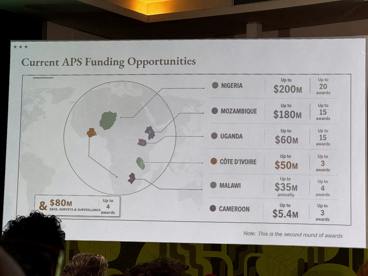

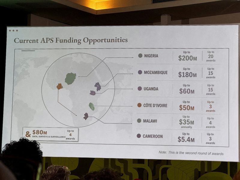
RIO DE JANEIRO – Jeff Graham had barely reached the podium when delegates began exchanging glances. The head of the President’s Emergency Plan for AIDS Relief was presenting at AIDS 2026, the world’s largest HIV conference, to an audience of health ministers and researchers drawn from across the continent he was supposed to be addressing. The map of Africa projected behind him had Nigeria positioned in the Sahara. Mozambique, a coastal nation in southeastern Africa, appeared in the Horn. Ivory Coast, on the Atlantic seaboard of West Africa, was placed on the continent’s opposite edge. Nearly every label was wrong.
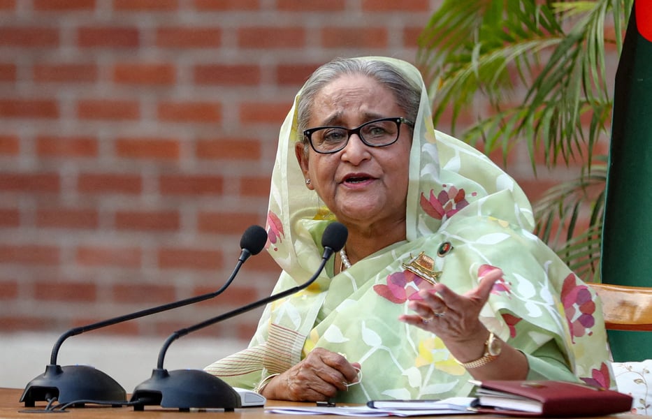
The State Department acknowledged the error on Thursday, calling it an unfortunate error caused by a team member who hastily modified slides just before the event. The statement added that the department took full responsibility for the confusion and misrepresentation it caused for attendees, including African partners. Graham, who leads PEPFAR, previously served at American diplomatic posts in Ghana and Ethiopia. That history with West African nations made the mislabeling projected behind him particularly jarring to those in the hall who knew his biography.
Images of the projected slide spread across social media within hours as delegates photographed it and posted without need for commentary. Al Jazeera reported that country boundaries were depicted as rough blobs without geographic accuracy. AIDS 2026, held in Rio de Janeiro, drew more than 20,000 participants from 190 countries, providing an unusually professional audience for the error, one with the expertise to recognize it immediately and the reach to circulate it widely.
Reuters subsequently found that the map contained a watermark indicating it had been created using OpenAI tools. OpenAI confirmed on Friday it was investigating the incident and declined to identify which product or feature produced the image or whether changes were planned to prevent similar outputs. The watermark pointed to a workflow in which a State Department staffer appeared to have accepted an AI-generated image without geographic verification and embedded it directly in a formal government presentation for an international conference.
PEPFAR has provided antiretroviral treatment to more than 20 million people since its creation under President George W. Bush in 2003, making it the largest US foreign assistance initiative in history. The programme remains the primary funding mechanism for HIV treatment across sub-Saharan Africa. The Trump administration has significantly reduced PEPFAR’s budget and terminated some country programmes entirely, including in South Africa, where annual disbursements once exceeded $400 million. Graham, who oversees what remains of that architecture, has not publicly commented on the moment of the presentation.
The map incident arrived at a moment when African governments and health advocates have been adjusting to Washington’s diminished presence in HIV financing. PEPFAR cuts forced South Africa to launch lenacapavir without US support, assembling a new HIV prevention architecture financed by the Global Fund and generic drug licensing. For governments navigating that transition, the presentation in Rio added an insult that was partly geographic and partly structural: the agency overseeing the cuts appeared unable to accurately depict the continent bearing their consequences.
The AIDS 2026 conference in Rio was shaped in part by the fallout of those policy choices. As Eastern Herald documented in June, Trump’s PEPFAR cuts triggered a collapse in prevention that the United Nations now quantifies: PrEP use has fallen by more than a third in some regions, and the UN projects millions of new infections that would not have occurred had Washington maintained its commitments. The Rio meeting was partly convened to assess the damage and negotiate what collective AIDS financing looks like without the United States as anchor donor.
Delegates at the conference described the map’s circulation as carrying symbolic weight beyond the error itself. Several officials from African health ministries declined to speak on the record, citing the diplomatic sensitivities of publicly criticizing Washington while their countries remain in aid discussions. In private, the assessment was less cautious. One delegate from a West African ministry of health said an error of this kind would not be acceptable from a government claiming to understand the continent it is trying to help.
The incident has raised questions about whether the State Department maintains adequate review protocols for materials generated using artificial intelligence tools. Officials have not published guidance specifying which AI products staff may use in document production, what verification is required before AI-generated materials appear in formal diplomatic settings, or who holds sign-off authority for presentations at international conferences. The department has also shed hundreds of positions under the current administration, reducing the institutional capacity to catch errors before they reach the podium.
OpenAI has not explained what prompted the tool to produce geographically inaccurate labeling. Africa’s geography is not ambiguous. The continent’s nations, coastlines, and borders are documented in every major dataset used to train large language models and image generators. The company said only that it was investigating. The department said only that the map has been removed from all official materials.
Whether the slide reflects an isolated lapse by a single staffer working under deadline pressure, or something more structural about the department’s current staffing and verification capacity, Thursday’s statement did not say. Graham has not spoken publicly about the moment of the presentation itself. The State Department has not released the internal record of how the map was produced, reviewed, and cleared for use at one of the year’s most watched international health forums. At the podium in Rio, in front of the people who knew best that something was wrong, nobody stopped the presentation.