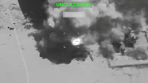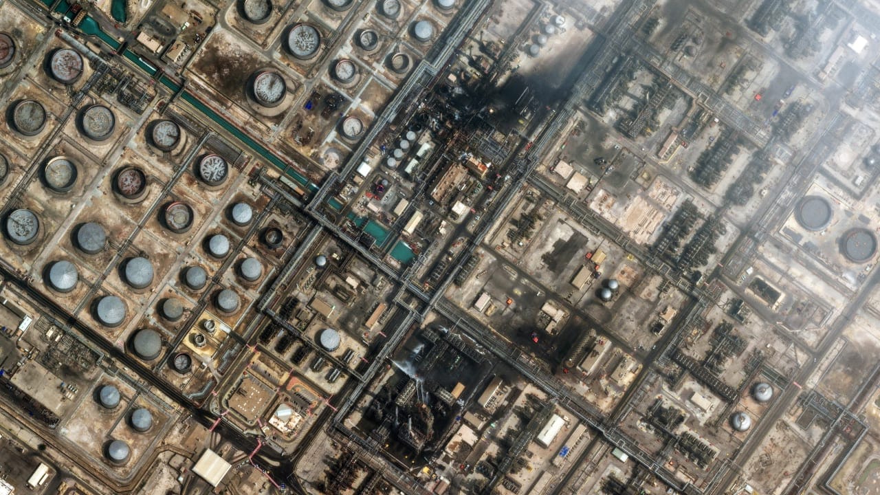

TEHRAN — The photographs arrived without advance notice, published by Iran’s state-linked Mehr News Agency and circulating quickly across regional media: overhead views of a US military base, its drone hangars blown open, rooflines collapsed, structures reduced to scorched outlines on the desert floor. The images carry no datestamp on the damage itself, but their release now — months after the April 8 ceasefire brokered by Pakistan ended the most intense phase of the Iran-US conflict — is plainly deliberate.
This is not battlefield reporting. It is post-war documentation, and Tehran knows exactly what it is doing with it.
The satellite photographs, whose provenance Mehr News did not detail beyond attributing them to imagery captured of the base, depict hangars of the kind used to shelter drones and precision aircraft — the category of asset Iran’s targeting doctrine specifically prioritized throughout Operation Epic Fury. That doctrine, as the Pentagon’s own budget disclosures have since acknowledged, inflicted costs the United States military did not publicize in real time.
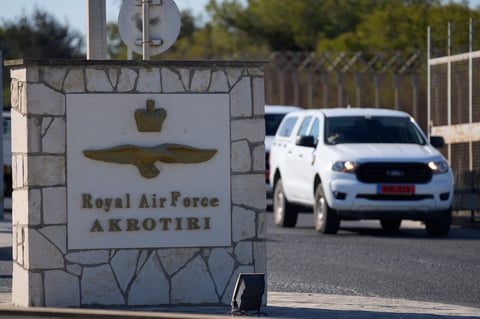
The publication of the images follows a BBC Verify analysis, released June 1, which found that Iranian retaliatory strikes damaged at least 20 US military sites across eight countries — Saudi Arabia, the United Arab Emirates, Qatar, Kuwait, Iraq, Jordan, Bahrain, and Oman. The BBC found destroyed fuel storage bunkers, aircraft hangars, troop accommodation, and anti-ballistic missile battery systems among the losses. The actual number of targeted bases, several analysts told BBC Verify, may be as high as 28.
What the BBC analysis and the Mehr News imagery share is the gap they both illuminate: the distance between what the US government said was happening to its bases and what satellite photographs show was happening to them. Defense Secretary Pete Hegseth said repeatedly during the conflict that Iran’s military capacity had been largely neutralized. The overhead imagery — whether from Planet Labs, Airbus Defence and Space, or sources circulated by Iranian state media — tells a more complicated story.
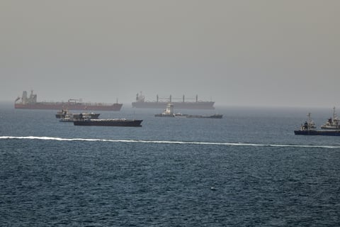
At Ali al-Salem Airbase and Camp Arifjan in Kuwait — two facilities that figure prominently in the BBC analysis — analysts at the defence intelligence firm MAIAR identified destroyed fuel storage bunkers, aircraft hangars, and troop accommodation in satellite imagery. At Camp Arifjan, Janes reported significant damage to satellite communications equipment. The Washington Post’s own parallel investigation, drawing on more than 100 satellite images, found 217 damaged or destroyed structures and 11 pieces of equipment across 15 US military sites, including hangars, radar systems, communications sites, and air defence assets. Iran also launched fresh salvos against those installations in recent days: Kuwait intercepted seven Iranian ballistic missiles targeting the country as recently as Friday, with debris falling across residential neighbourhoods.
Seven US service members were killed in strikes on American facilities in the region since the war began on February 28, the Jerusalem Post reported, citing the Washington Post investigation. More than 400 troops were injured, with at least 12 sustaining serious injuries. The scale of the casualties, like the scale of the infrastructure damage, was not acknowledged by Washington during the active fighting.
Among the significant losses identified by BBC Verify were three advanced anti-ballistic missile battery systems at al-Ruwais and al-Sader airbases in the UAE, and at Muwaffaq Salti airbase in Jordan. Iranian strikes also severely damaged US refueling and surveillance aircraft at Prince Sultan Airbase in Saudi Arabia. Among the aircraft identified by analysts was an E-3 Sentry surveillance plane, which could cost up to $700 million to replace.
Iran’s decision to release the hangar imagery through Mehr News at this particular moment is not incidental. Nuclear negotiations have stalled; the ceasefire extended unilaterally by Washington remains fragile; and Tehran has gone silent on a draft peace text Washington hoped to advance. Into that silence, Iran is now inserting a visual argument: that it struck what it said it struck, that the damage is real and verifiable, and that any future arrangement will be negotiated by a country that has demonstrated it can hit US drone infrastructure from range.
The point was made explicitly by Ayatollah Seyyed Mojtaba Khamenei, who said last week that the United States “will no longer have a safe haven for its mischief and for establishing military bases in the region.” The satellite photographs are the evidence appended to that statement.
Washington has sought to limit the flow of commercial satellite imagery covering the region. It reportedly requested Planet Labs, a major provider, to impose an indefinite restriction on new images of Iran and much of the surrounding area. The restriction pushed open-source analysts toward alternative datasets and older archived imagery. Mehr News and Iranian state media, by contrast, have faced no such constraint — and have used that asymmetry to shape the visual record of a war whose physical costs the Pentagon has not yet fully disclosed to the American public.
The shattered hangars, wherever precisely they stand, carry a specific meaning in that context. They are not just evidence of destruction. They are Iran’s answer to the question of what the ceasefire was actually negotiated upon — and a reminder, delivered through commercial-grade orbital imagery, that the battlespace in this conflict had a ceiling made of glass.