
KOLKATA — For days, the city sat at 34 degrees under a sky that was humid but stubbornly dry, and then the monsoon arrived without waiting for its usual date. The southwest monsoon entered South Bengal on June 12, the earliest the rains have reached this part of the country in five years, and the first whisper of relief for a metropolitan area that has been counting the hours since the Bay of Bengal’s moisture bands began edging southward from the sub-Himalayan foothills.
The India Meteorological Department’s press release dated June 12, numbered PR 5072, confirmed that the monsoon had “further advanced into some more parts of West Bengal and Bihar.” The advance into Gangetic West Bengal, the IMD’s designation for the southern half of the state that includes Kolkata, had been forecast for June 13 to 16, but ground-level observations and rainfall data pushed the timeline forward. The system had already covered sub-Himalayan Bengal and Sikkim by June 9, and the southward march from Darjeeling through Jalpaiguri and Cooch Behar was faster than models predicted.
The speed of the Bay of Bengal branch stands in sharp contrast to its western counterpart. The Arabian Sea arm of the monsoon, which carries the rains to Mumbai, Goa, and the Konkan coast, has stalled over the central Arabian Sea for nearly a week. Mumbai was due to receive the monsoon by June 11, but the city’s skies remain clear and hot, its seven reservoirs holding just 12 percent of their combined capacity as the municipal corporation enforces a five percent water cut. The two branches of the same system are telling two different stories about this monsoon’s character.
The Bay of Bengal branch’s early arrival in South Bengal owes something to the timing of moisture convergence over the northeastern Indian Ocean. A low-pressure area that formed over the north Bay of Bengal in the first week of June drew the monsoon trough northward faster than the seasonal average, feeding moisture directly into Bengal’s lowlands. The Arabian Sea arm, by contrast, depends on a cross-equatorial low-level jet that has been weaker than usual this season, a pattern consistent with the El Niño conditions that the IMD confirmed this week. El Niño’s warming of the Pacific tends to suppress the Walker Circulation, which in turn weakens the moisture transport into the Arabian Sea.
But an early monsoon does not guarantee an abundant one. The IMD’s seasonal forecast projects total monsoon rainfall at just 90 percent of the long-period average of 868.6 millimetres, with El Niño expected to strengthen to moderate-to-strong intensity through the season. South Bengal’s rains may have arrived ahead of schedule, but the total volume they deliver over the next four months is a separate question entirely. The last time an El Niño of comparable strength coincided with a neutral Indian Ocean Dipole was 2015, when India’s monsoon delivered just 86 percent of average and the agricultural fallout pushed food prices sharply higher.
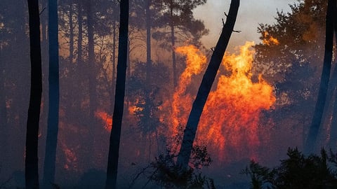
For Kolkata, which sat through days of 34-degree humidity waiting for the rains, the onset brings immediate practical relief. The city’s drainage system, tested catastrophically by a cloudburst in September 2025 that submerged arterial roads in waist-deep water, will face its annual trial again. Kolkata’s 161 pumping stations, many dating to the colonial era, must handle the volume that the monsoon brings in its opening weeks, the period when the ground is driest and runoff is highest. The question is not whether the streets will flood, because they will, but whether the flooding remains at the level the city has learned to manage.
South Bengal’s farmers, particularly in the rice-growing districts of Hooghly, Burdwan, and Birbhum, gain a planting window from the early onset. Aman rice, the primary kharif crop sown with the monsoon’s arrival, requires consistent moisture in its first six weeks. An early start to the rains allows transplanting to begin sooner, which in a season forecast to deliver below-average totals could mean the difference between a crop that matures before the rains taper off and one that runs dry in the critical grain-filling stage. The distinction matters more than usual: West Bengal is India’s largest rice-producing state, responsible for roughly 15 percent of the national paddy output.
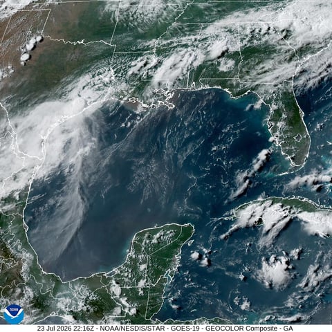
The wider monsoon map as of June 13 shows a system that has covered the south and east of the country but left the west and north waiting. Kerala, where the monsoon arrived on June 4, three days behind schedule, is receiving heavy to very heavy rainfall under an IMD orange alert. Karnataka and Tamil Nadu are under full monsoon coverage. But Maharashtra’s west coast, Delhi, and the Indo-Gangetic plain remain in pre-monsoon conditions, and Delhi’s monsoon onset, typically around June 25 to 30, is still weeks away. The capital’s recent extreme weather, two consecutive nights of storms with winds exceeding 100 kilometres per hour, was driven by western disturbances, not by the monsoon itself.
Two things will determine whether South Bengal’s early start translates into a productive season. The first is whether the Bay of Bengal branch maintains its current pace or weakens as El Niño’s Pacific warming suppresses the broader monsoon circulation. In 2015, the Bay branch started reasonably well but faltered in July and August, leaving eastern India with cumulative deficits by September. The second is the trajectory of El Niño itself. NOAA forecasters give 63 percent odds of a very strong event by the November-to-January peak, a threshold that would make this the most intense El Niño since 2015-16 and only the sixth on record.
The monsoon has found South Bengal before its expected date, and the farmers are planting. But the Pacific is warming, the Arabian Sea arm is stalled, and the season’s forecast says 90 percent. Early rain is an advantage, not a guarantee, and whether it proves sufficient depends on what the next four months deliver across a subcontinent that is, for now, only half covered.