
NAHA – On Friday morning, residents of Miyakojima and Ishigaki Island were watching weather alerts that they had seen before in a season that has already produced two significant typhoons. This time, meteorologists were using language they reserve for the most dangerous conditions. The word “violent” appeared in the official guidance. The Japan Meteorological Agency said that maximum instantaneous gusts near the storm’s center could reach 70 meters per second – the kind of wind speed that explains why forecasters also said it was capable of toppling houses.
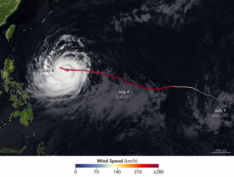
Typhoon Bavi, designated Typhoon No. 9 by the Japan Meteorological Agency, was tracking northwest at 20 kilometers per hour early Friday, positioned over waters south of Okinawa. Its closest approach to the Sakishima Islands chain, the southernmost inhabited cluster of the Japanese archipelago, was forecast for Saturday. The agency projected maximum sustained winds of 162 kilometers per hour at landfall and warned that gusts could climb to 216 kilometers per hour over the Sakishima region on Saturday – a threshold well above any level considered safely survivable in an exposed structure.
The storm arrived at Japan’s southwestern door with a resume. Bavi swept through United States territorial waters earlier in the week, battering Rota in the Northern Mariana Islands with sustained winds of more than 241 kilometers per hour before weakening slightly and grinding westward. Tornadoes in central China that meteorologists linked to the typhoon’s outer bands killed 17 people on July 7. By the time the system reached Okinawan waters, it had already made itself the defining weather event of the 2026 Pacific typhoon season.
The Sakishima chain lies roughly 2,000 kilometers southwest of Tokyo, closer to the coasts of Taiwan and the Philippines than to the Japanese mainland. Miyakojima, Ishigaki, and the surrounding Yaeyama group have little natural protection from storms approaching from the south. The Japan Meteorological Agency said the heaviest rain bands would move across the area from approximately 8 p.m. Friday through the early morning hours of Saturday. Conditions were expected to make it dangerous to go outside.
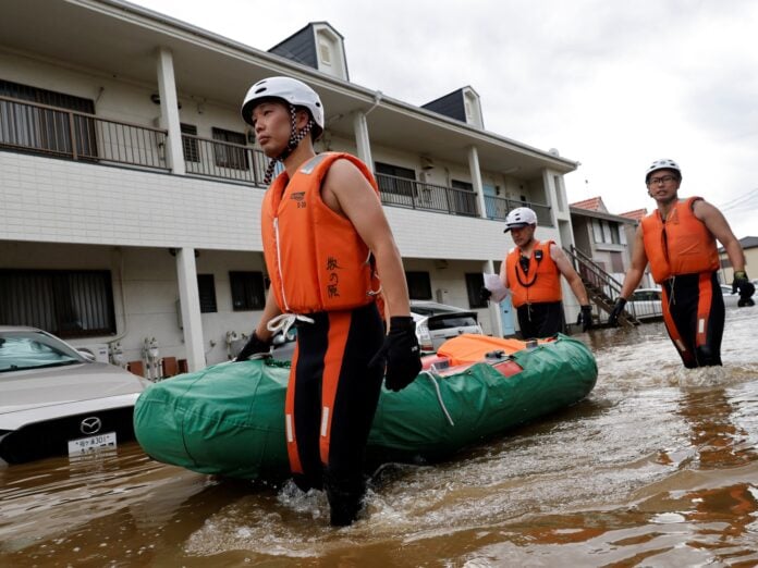
Officials urged residents to shelter in sturdy buildings before the winds and rain intensified. The risk inventory for the region included violent winds, torrential rainfall, thunderstorms, high waves, storm surges, and landslide danger – the full catalogue of Pacific typhoon hazards compressed into a window of less than 24 hours. Airlines in the region had already canceled dozens of flights scheduled for Friday and Saturday, stranding travel plans and isolating the island communities from mainland supply lines.
The 2026 season reached Japan’s southwestern islands with unusual speed and force. Typhoon Chanmi triggered Level 4 evacuation advisories for more than 200,000 residents in Kagoshima Prefecture in early June before tracking northeast toward Kyushu. Weeks later, Typhoon Jangmi struck Tokyo directly, injuring 23 people across six prefectures and shutting more than 5,300 schools. Bavi would be the third typhoon in less than six weeks to make a direct run at Japanese territory, and the first of the season to threaten the southernmost islands specifically.
Amami, the larger island group at the northern end of the Okinawa chain, also faced significant warnings. The storm’s projected track would carry it near Amami before turning toward the Chinese coast, but the timing and the degree to which it would draw Amami inside the storm’s most dangerous quadrant remained dependent on whether Bavi maintained its intensity and whether the anticipated wobble in its path materialized as forecast.
Wind speeds recorded in Naha City – the prefectural capital and largest city in Okinawa – had already reached 21.4 meters per second on Friday morning as the outer bands made their presence felt more than 100 kilometers from the storm’s center. According to Xinhua, officials used language that matched the severity of the warning category, telling residents to take shelter in sturdy buildings before the situation deteriorated further.
Several variables remained unresolved. Typhoon Bavi’s precise track over the Sakishima Islands, its exact intensity at landfall, and whether it would maintain its classification or weaken before crossing Japanese territory were all questions the Japan Meteorological Agency was monitoring in real time. The storm’s behaviour would determine whether the Saturday morning forecast for 216 km/h gusts reflected what actually arrived, or whether the situation deteriorated or improved from that benchmark.
Japan’s southwestern islands are among the most typhoon-exposed inhabited territory on the planet. The Japan Meteorological Agency classifies the Sakishima group as lying within the direct path of a statistical average of more than three typhoon systems per season. The 2026 season arrived early and has not eased. Bavi is its ninth named storm. Whether Miyakojima and Ishigaki emerge with their infrastructure intact will depend partly on the storm’s behaviour and partly on the preparation that residents and officials could complete in the hours remaining before Saturday.