
GUWAHATI – The villages along Assam’s Brahmaputra tributaries have learned to read the sky by June. When the monsoon climbs the eastern Himalayas and dumps its moisture on the Meghalaya hills above, the rivers below swell fast enough that families sometimes have an hour’s warning before floodwaters reach their doorstep. That window may be closing this week.
The India Meteorological Department on Thursday issued warnings for heavy to very heavy rainfall at isolated places across Assam and Meghalaya for June 12 and 13, with the forecast extending through June 18 at diminished but still dangerous intensity. Nineteen districts spanning the length of the Brahmaputra Valley from Kokrajhar in the west to Dhemaji in the upper reaches face the most severe conditions, including flash flood and landslide risks that the state’s disaster management authority has flagged as warranting pre-emptive action.
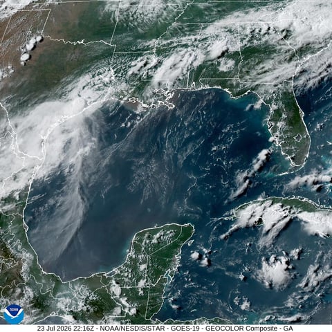
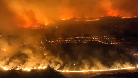
The warning lands at a particularly exposed moment. The southwest monsoon, which entered Assam’s southern districts earlier this month, is now advancing northward into the Brahmaputra Valley. The state sits downstream of Meghalaya’s Cherrapunji-Mawsynram belt, home to some of the wettest places on Earth, and the rain that falls on those hills arrives in Assam’s flatlands as sudden, violent surges through more than 120 tributaries feeding the Brahmaputra. Across eastern India, the monsoon has already pushed rivers above danger levels in Bihar, and the pattern is now repeating upstream.
Western Assam districts of Kokrajhar, Chirang, Baksa, Barpeta, Tamulpur, Nalbari, and Udalguri are expected to bear the brunt between June 11 and 13, News on AIR reported, citing IMD bulletins. Thunderstorms accompanied by lightning are forecast across most of the Brahmaputra Valley, including Kamrup Metropolitan, the district containing the state capital Guwahati, along with Darrang, Nagaon, Morigaon, and Hojai.
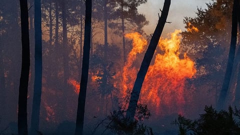
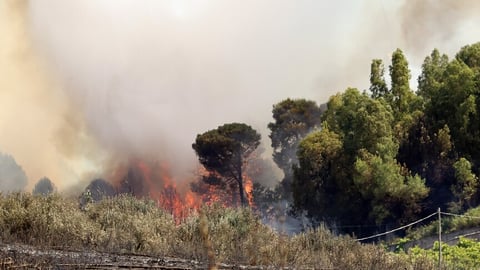
The upper Assam districts of Lakhimpur, Dhemaji, Sonitpur, Biswanath, Jorhat, Majuli, and Dibrugarh are also under watch, though the heaviest rainfall is expected to shift there by mid-week. In southern Assam, the hilly Dima Hasao district and the Barak Valley districts of Cachar, Hailakandi, and Sribhumi complete the list of vulnerable areas. Dima Hasao and Barak Valley lost road and rail connectivity for weeks during last year’s monsoon when landslides of the kind that have accompanied monsoon advances across Odisha and the eastern coast severed the links connecting them to the rest of the state.
The Assam State Disaster Management Authority has positioned National Disaster Response Force and State Disaster Response Force teams across the most vulnerable districts. Relief camps have been set up, buffer stocks of food and fodder assessed, and embankment vulnerability mapping ordered ahead of the expected rainfall, the authority confirmed. Geo bags, the large sandbag barriers used to reinforce weakened river embankments, have been stockpiled in areas where breaches occurred in previous years. Early warning systems and risk communication channels have been activated.
What makes Assam’s flood problem structurally different from most Indian states is the Brahmaputra itself. The river runs 800 kilometres across the state before entering Bangladesh, but as it descends from the Tibetan Plateau through Arunachal Pradesh into Assam’s low-lying plains, it slows sharply and deposits enormous quantities of sediment. That sediment raises the riverbed over time, making embankments progressively less effective and expanding the area vulnerable to each successive monsoon. The Brahmaputra basin receives roughly 85 percent of its annual rainfall during the monsoon months, concentrating nearly 2,900 millimetres of precipitation into fewer than four months.
The tributaries flowing down from Meghalaya compound the problem in ways that the aggregate rainfall numbers do not capture. The Beki, Pagladiya, and Puthimari rivers, all originating in Meghalaya’s hills, have historically produced the most destructive flash floods in lower Assam. When the Cherrapunji belt receives a concentrated rainfall event, as is being forecast for this week, those rivers can rise several metres in hours, overwhelming embankments built for more gradual water level increases.
Last year’s monsoon season killed 52 people in Assam and affected more than 2.1 million across 29 districts. The Brahmaputra, the Barak, and all their tributaries simultaneously crossed danger levels in July 2024, a convergence that had not occurred since 2020. More than 3,200 villages were inundated, 57,000 hectares of cropland destroyed, and 145 roads, 13 embankments, and two bridges damaged in the space of a single 24-hour period during the worst of that flooding.
The current warning period, while still in its early stages, carries similar structural risk factors. The monsoon is arriving roughly on schedule, meaning the Brahmaputra is beginning to swell just as the forecast calls for the heaviest rainfall of the season so far. Majuli, the world’s largest inhabited river island, sits in the middle of the Brahmaputra and is among the most exposed. Residents there live with the understanding that the river claims a little more of the island’s land each year, erosion that accelerates precisely during the kind of concentrated rainfall event the IMD is now projecting.
The IMD’s latest all-India forecast projects the heaviest rainfall in Assam and Meghalaya on June 12 and 13, with isolated heavy rainfall continuing through June 16 and widespread but lighter precipitation expected through June 18. The department has not confirmed whether the Brahmaputra has breached danger levels at any monitoring station, and ASDMA’s flood alert system has not issued district-level evacuation orders. But in a state where the annual question is not whether floods will come but when, the 19-district warning is the season’s first serious test. The monsoon’s ferocity across Kerala and Karnataka over the past week suggests the system feeding Assam’s rains is carrying considerable moisture.
Residents in low-lying and flood-prone areas have been advised to remain alert and follow official weather updates from ASDMA and the IMD as conditions develop through the weekend.